Current projects
Wilderness Search and Rescue (WiSAR)
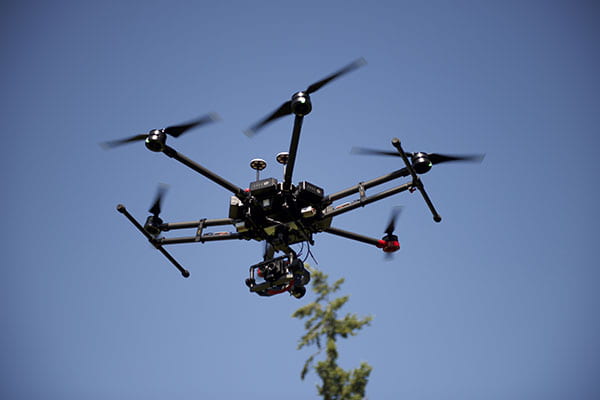
We utilize high performance computing and state-of-the-art computer vision algorithms to provide autonomous perception capabilities for UAVs to aid first responders in search and rescue operations in wilderness environments.
Beyond Visual Line of Sight Operations
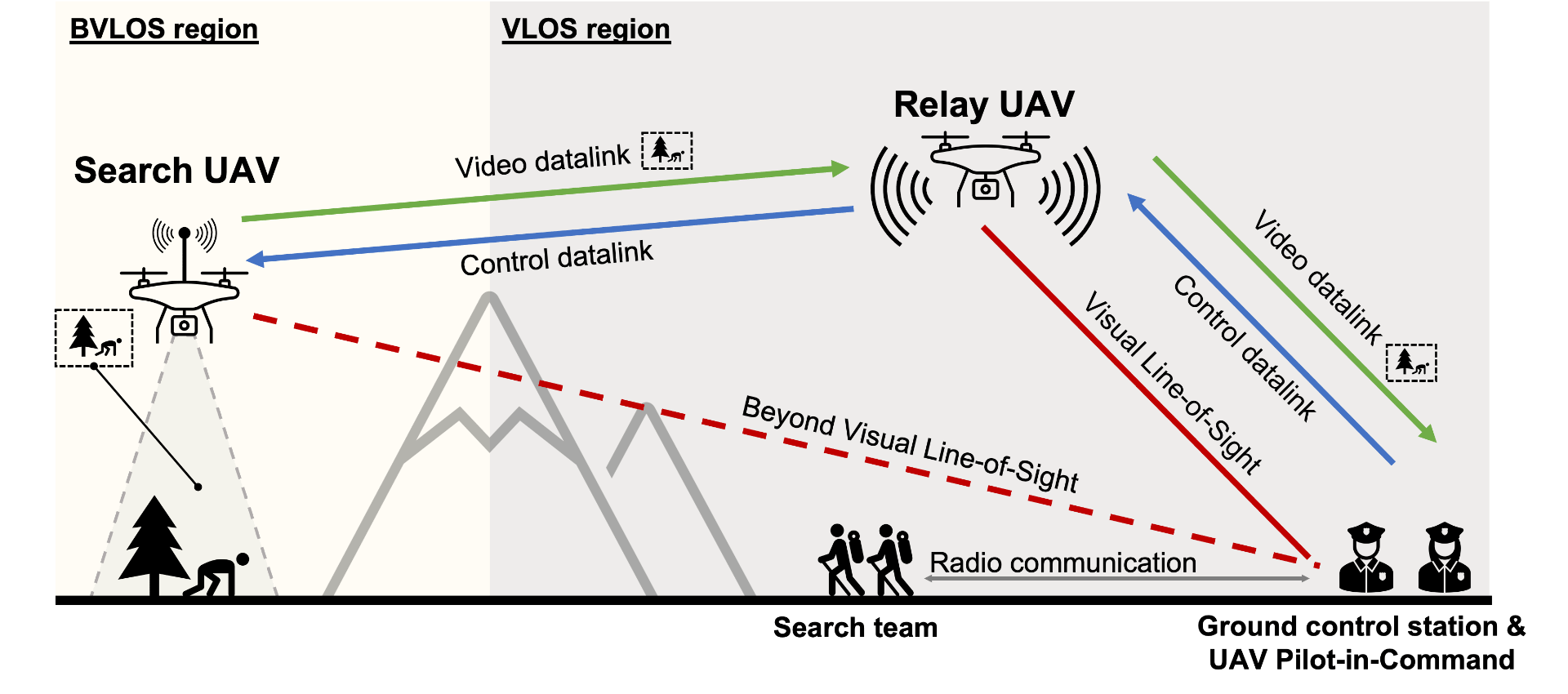
Sensor-equipped small Unmanned Aerial Vehicles (UAVs) provide a cost-effective solution to accelerating the time-sensitive search and locate phases of Wilderness Search and Rescue (WiSAR) operations, the process of finding, geolocating, assisting and evacuating person(s) lost in wilderness areas. The search radius for UAVs is limited by current FAA regulations requiring UAV operations to stay within Visual Line-of-Sight (VLOS). We propose expanding the search radius by developing a novel Beyond Visual Line-of-Sight (BVLOS) UAV system utilizing an intermediate “relay UAV” to provide an uninterrupted communications link between the ground station and the search UAV. The proposed system will provide continuous sensor data and control flow between the search UAV and ground station, enabling the WiSAR team to dynamically update the UAV’s search strategy.
Past projects
Aerial Mapping of Fire Behavior and Vegetation (AMFAV)
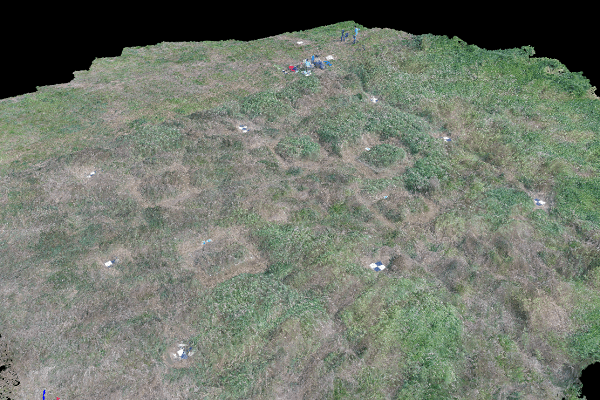
We use aerial imagery from a UAV to analyze features of the landscape, using a technique called photogrammetry. Photogrammetry is the process of stitching a set of 2D images together to form a 3D model of the landscape. We have partnered with the US Forest Service to conduct photogrammetric surveys of grasslands to analyze forest fire propagation, as well as with the Chelan-Douglas Land Trust to use this technique to survey and monitor wilderness areas. We hope to combine photogrammetric models with data from other sensors, such as LiDAR, to produce high-accuracy models of vegetation, terrain, and other ecologically significant landscape features.
CellNav
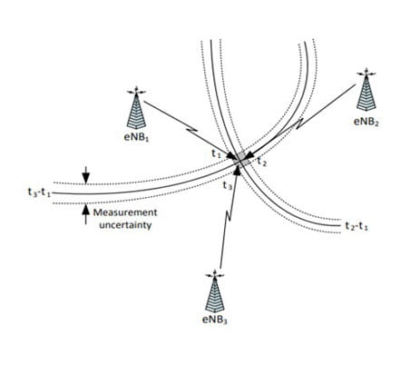
CellNav is a payload that uses multilateration to back out where it is in the reference frame. The idea is that if you know how far away several (at least 3) cell towers are from you AND you know their locations, you can figure out where you are. CellNav consists of two main modules, the cell modem and the payload computer. CellNav needs no ground station and does all of its computation and logging onboard the aircraft. The ideal situation is that CellNav is a plug and play solution that can replace a GPS receiver by delivering the same data at the same rate.

EarthLab Air Quality UAV
In partnership with the UW Terrain and Cryosphere Analysis Lab
Communities around Seattle/King County have registered high concentrations of ultrafine particle air pollution. This project aims to understand how vegetation can help reduce the air pollution from both air and car travel in horizontal and vertical directions. To conduct this study, we will deploy a UAV equipped with air quality sensors to measure air quality at different sites with varying vegetation density, ultrafine particle sources, and altitudes. These findings will inform cities across the country on how vegetation impacts air pollution in communities.
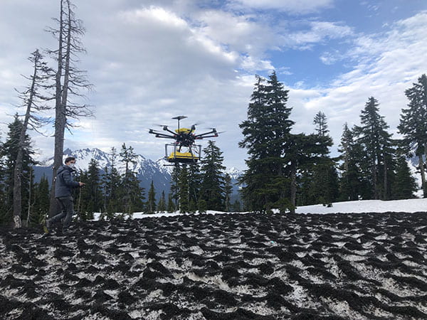
UAV Ground-Penetrating Radar (GPR) System for Autonomous Snow Depth Mapping
In partnership with the UW Terrain and Cryosphere Analysis Lab
We attach GPR to a UAV to measure the variable depths of snow cover. The project is studying the best sampling strategies for the UAV when at different altitudes, including spiral and grid patterns.
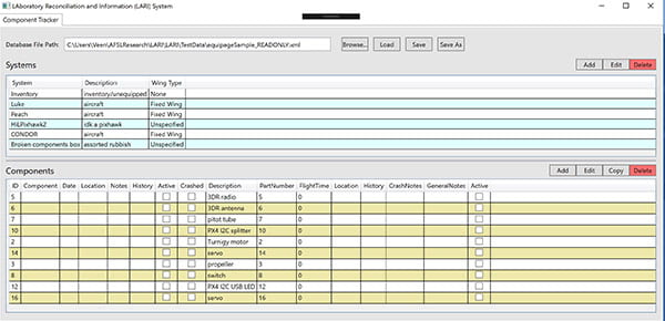
Laboratory Reconciliation and Information System (LARI)
We maintain a fleet of over a dozen UAVs, which we fly regularly and perform regular maintenance and repairs. To facilitate this, we maintain a database containing relevant statistics on every component in each of our drones, including cumulative flight time, and the complete history of every part. The Laboratory Reconciliation Information System (LARI) aims to create an application that tracks system components for our drones. Our goal is to streamline the workflow to increase efficiency in the lab. The next step in the LARI project is to create auto-generated pre-flight checklists based on the components and payload onboard the drone.
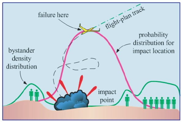
Risk Assessment
As UAVs become more common in our airspace, assessing and quantifying the risk they pose to bystanders is becoming increasingly important. Our Risk Assessment research comprises two projects: Trajectory Of Failed UAVs (TOFU), and Risk of Unmanned Aircraft Collisions with Humans (RUACH). The TOFU project involves the development of a simulation to model the trajectory of a UAV during a crash. The RUACH project aims to quantify the risk to humans on the ground should a UAV above them fail. This research will provide a clearer picture of the hazards associated with UAVs, and contribute to the safe integration of unmanned aircraft into the National Airspace System.
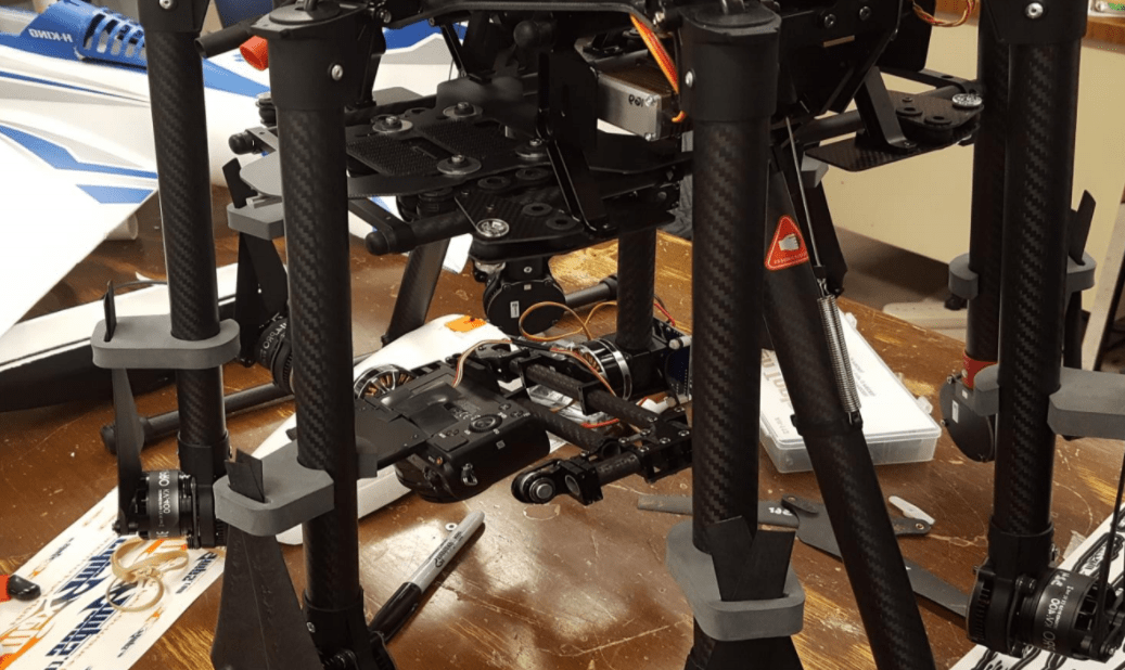
MicaSenseAerial Pointing and Stabilization System
The MicaSenseAerial Pointing and Stabilization System (MAPSS) is a modular attachable gimbal apparatus which keeps the attached sensors facing nadir. We intend to develop a working prototype gimbal with mounting points for RedEdge and one other accessory sensor.
Categorizing the tolerable vibrations while keeping image quality high is also part of the project. If successful, MAPSS would remove the need for potentially dangerous homemade mounting hardware by the MicaSense customer base while increasing the quality of flight missions through the nadir-facing controls.
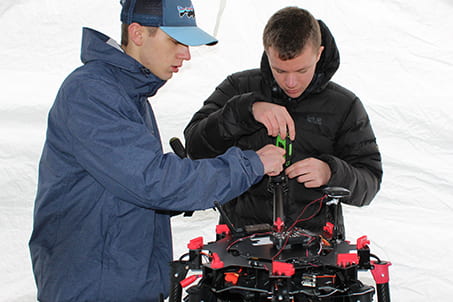
Characterizing UAS Wireless Communication Links
We worked on a Joint Center for Aerospace Technology Innovation project with the Fundamentals of Networking Lab in the Department of Electrical Engineering to test the integration of software defined radios (SDRs) with unmanned aerial vehicles. Currently, we are performing flight tests to gather data to be able to characterize the link quality between a UAV based SDR and a ground SDR. At the end of the project, we aim to release a database that contains link quality and UAV telemetry data for public use.
Visual Anchoring
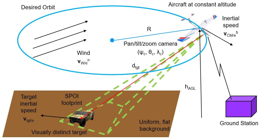
We worked on autonomously establishing an orbit around a target of interest using vision as the primary sensor. This would improve the capability for autonomous UAVs to operate in GPS-denied environments. The Visual Anchoring team developed an autonomous control algorithm to establish an orbit with a fixed wing UAV and implemented it on Pixhawk flight controller. The team also developed a vision system that can track a visually distinct target in real time and estimate the distance between the aircraft and the target.
Transponder Based Position Information System (TRAPIS)
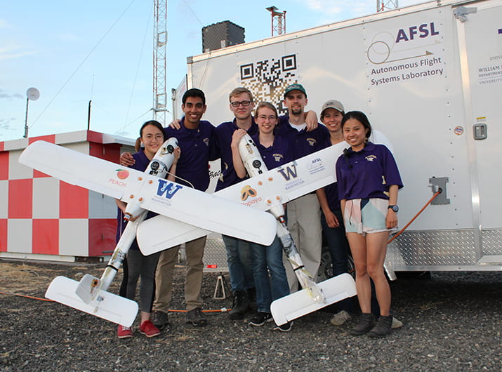
We combined position data from multiple sources into a consistent position estimate. This will further allow determination of aircraft position in GPS denied environments. In addition, secondary software applications can use the functionalities of UW TRAPIS to drive other autonomy applications. The project has successfully used ANPC’s Local Area Multilateration System (LAMS) to navigate a UAV without any GPS data going directly to the plane. Currently, the AFSL is investigating and integrating other potential sources of position data.
A Risk-Based Paradigm and Model for Unmanned Aerial Vehicles in the National Airspace
A major focus of current unmanned systems operations is assessing the inherent risk associated with a mission. Efforts to integrate unmanned systems into the national airspace require manufacturers be able to calculate the risk of a mission in terms of human safety. Threats to human safety from midair collisions and ground strikes are the focus of the risk model. The project’s intent is to assist in determining applications that leverage the strengths of current unmanned aircraft technology while mitigating the weaknesses so as to meet or exceed the safety and economic viability of manned aircraft. The validity of the risk model is demonstrated by comparison to historical data when available. The intended use of the tool is discussed and risk assessments are presented for several example scenarios. Resources for gathering the required information are surveyed and material is developed to aid a general audience in performing a risk assessment.
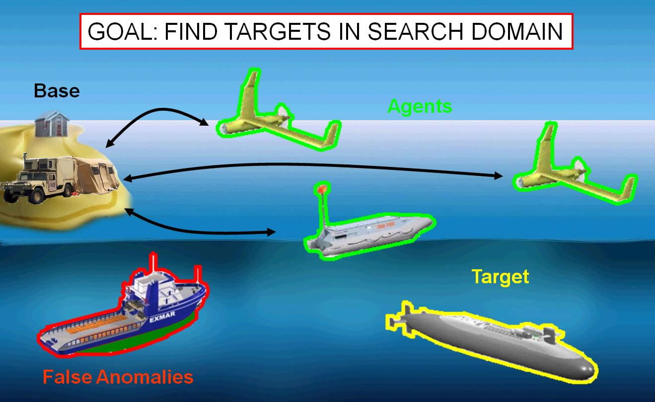
Coordinated Search and Target Identification Using Teams of Autonomous Agents
Many modern autonomous systems actually require significant human involvement. Often, the amount of human support and infrastructure required for these autonomous systems exceeds that of their manned counterparts. This work involves increasing both the tactical and strategic decision making capabilities of various autonomous systems. The application considered is the problem of searching for targets using a team of heterogeneous agents. The system maintains a grid-based world model which contains information about the probability of a target being located in any given cell of the map. Agents formulate control decisions for a fixed number of time steps using a modular algorithm that allows for capabilities and characteristics of individual agents to be encoded in several parameters. The resulting research patterns executed by the agents guarantee an exhaustive search of the map in the sense that all cells will be searched sufficiently to ensure that the probability of a target being located in any given cell is driven to zero. This system was simulated using high fidelity simulations with heterogeneous agents in complex and dynamic environments. After performing successfully in simulation, these algorithms were then verified and validated on a distributed human-in-the-loop simulator. This system allows a human operator to handle low level tasks such as state stabilization and signal tracking while preserving the contributions of the autonomous algorithm. Finally, flight test results are presented showing the benefits of augmenting a human system with these types of autonomous algorithms.
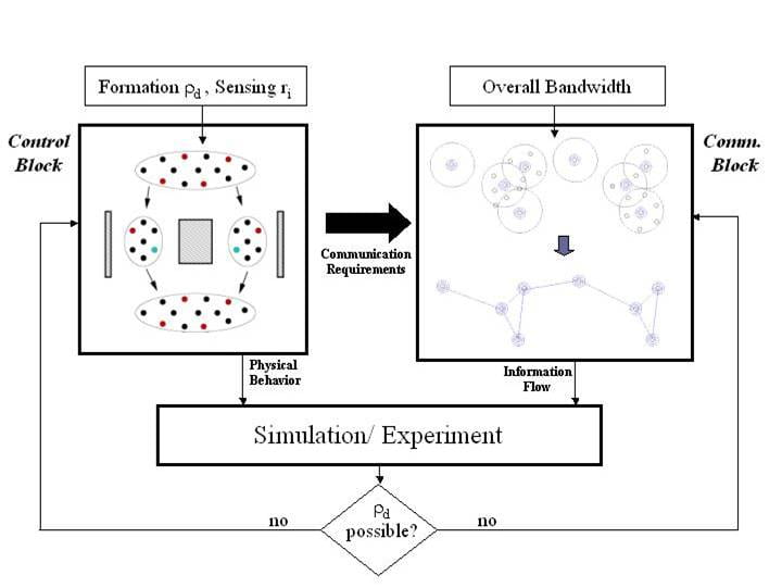
Hierarchical Integrated Communication and Control
We designed integrated control and communication algorithms that guarantee that a set of vehicles with differing data capabilities will conform to a specified spatial distribution. Unlike most coordinated control settings, we are not only interested in the question of formation control, but also the question of reliably providing the communication necessary to achieve the coordination. Each vehicle is equipped with physical devices that provide local information from sensing and global information from communication. Sensing devices are assumed to be lower cost in terms of power, computation, and range of operation, while communication devices are comparatively higher cost but with more information density and reconfigurability. While each vehicle is equipped with a communication device, not all vehicles will be allowed to use these devices due to resource limitations, environmental constraints such as bandwidth, and/or failure of the device. Such scenarios are typical of multiple autonomous aircraft in urban settings or multiple autonomous underwater vehicles in shipyards.
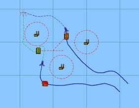
Cooperative Planning for Teams of Heterogeneous Autonomous Vehicles
In this research, we investigated dynamic planning for a team of autonomous vehicles to cooperatively execute a set of assigned tasks. The emphasis was on system architecture, planning algorithms and uncertainty management.
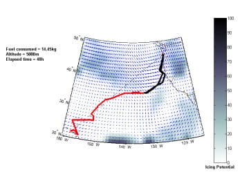
Path Planning with Realistic Weather Models
This research involves the integration of weather information from actual databases and forecast algorithms with evolutionary path planning techniques for long range autonomous flights. It addresses a 4-dimensional problem of space and time, requiring adaptation to account for unexpected changes in the environment. The objective is the planning of trajectories that balance fuel consumption, icing hazard avoidance and observation requirements, considering performance characteristics of the target vehicle.
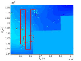
Autonomous Airborne Geomagnetic Surveying and Target Identification
This project focused on using total magnetic intensity measurements to search and identify magnetic anomalies in a predetermined area. The challenge is to use noisy sensor measurements to identify and classify these anomalies. This concept is integrated with a centralized occupancy based map search idea to apply to a team of autonomous agents.

Formation of Flight of Swarms of Autonomous Vehicles in Obstructed Environments
Maneuvering a single vehicle from one location to another is a common problem in many autonomous systems. This problem becomes more complicated when an operator wants to maneuver multiple vehicles simultaneously in a coordinated fashion through a complex and potentially dynamic environment. This work investigates a modular control strategy which allows a group of vehicles, or swarm, to move in formation from a starting location to an ending location in space while navigating various obstacles and obstructions in a cluttered environment. The algorithm structure allows different aspects of the controller to be tuned and modified as desired for a specific task. High fidelity simulation is used to verify the algorithm before transitioning to flight test using multiple autonomous vehicles in real time.
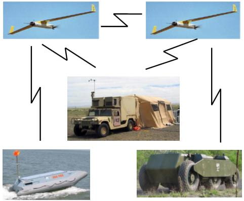
Intermittent, Asynchronous Communications for Cooperating Teams of UAVs
Applications and scenarios of cooperative control of heterogeneous vehicle ensembles with communication constraints have been receiving increasing attention during the past several years. The driving technology behind this attention is the fact that in coordinated vehicle activities information about vehicle states, trajectory planning, and collected data must be shared among the group of vehicles, generally via data transmission. Current approaches to communication are ad hoc drawing on existing communications network technology. Specifically, techniques for coordinated control often assume continuous and uninterrupted transmission. Studies of static communication patterns among vehicles have shown that certain patterns prevent convergence to desired group behaviors. Dynamic communication patterns have been studied in a few limiting cases. When dynamic communication patterns are assumed to be periodic, different choices of pattern can be shown to either stabilize or destabilize group behaviors. Further results have been obtained for cases of random communication patterns for synchronous and instantaneous error-free communication. These results for random patterns, however, are either taken in a limit or do not allow for changing group membership and focus on analysis rather than synthesis.
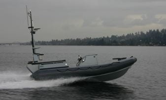
Autonomous Guidance, Control and Communications for Unmanned Surface Vehicles (USVs)
We investigated adaptive real-time planning, control and communication architectures for on-board implementation for small USV platforms to give the vehicles greater autonomy, as well as enable cooperative operation with UAVs.
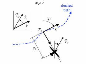
Guidance for Autonomous Vehicles
In this project, we developed algorithms for fight path guidance and synchronous camera angles for UAVs to observe targets. The observation of the target is affected by the environment (e.g. sun angle, wind), maximum aircraft performance, and camera limits. Using minimal heuristics, a guidance law based on good helmsman behavior is developed and implemented, and stability of its integration with inner loops is assessed.
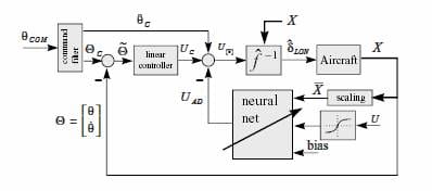
Non-linear Adaptive Control
This research focused on the use of a direct Neural Network based adaptive control architecture that compensates for unknown plant nonlinearities in a feedback linearizing control framework. We analyze the system performance and stability based on Lyapunov theory. Robustness to actuator dynamics is a topic of interest.
Collision Warning System for Multiple Unmanned Aerial Systems
The FAA scheduled to open the National Airspace System by 2015 for all unmanned aerial systems (UAS). To help with this transition, our team developed software and algorithms that provide situational awareness to UAS operators about potential conflicts. We partnered with Insitu Inc. and were funded by the Washington Joint Center for Aerospace Technology Innovation (JCATI). The collision awareness system will be integrated onto Insitu’s ground control station and be compatible with STANAG 4586 vehicles.

