Category Archives: Marine Debris

What’s Washed In – August 12, 2015

Hi COASSTers,

Summer signals COASST’s busy season, especially along the West Coast – exhausted breeders (and their chicks) arrive on COASST beaches beginning in July. Alan, who surveys Bob Creek and Stonefield Beach sounded the alarm about dozens of Common Murre chicks on Oregon South beaches. Staff at three partner organizations, Alaska Maritime National Wildlife Refuge (Leslie Slater), the International Pacific Halibut Commission (Tracy Geerneart), and Washington Sea Grant (Ed Melvin) alerted COASST to two wrecks in Alaska – murres near Homer, shearwaters, fulmars, and murres near St. George Island.

With the wreck season upon us, here are some helpful tips to expedite processing lots of birds:

  • after the 10th bird, don’t measure – record, tag, and photograph only
  • process birds as a group – record, tag, and photograph together: we sometimes bring a 5-gallon bucket along to assist with this
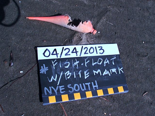
  • bring extra helping hands and delegate people to specific tasks: one person tags and measures, one person takes notes, one person takes photos and writes on slate

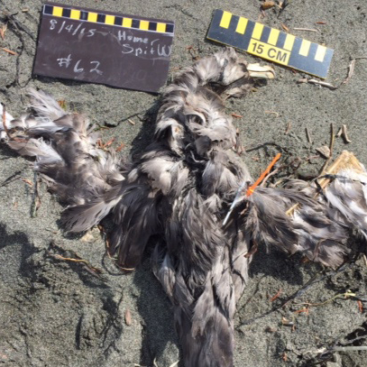
Watch out for those Alcid chicks! Below, we’ve profiled two sets of four birds – in each of the sets, one species is not the same as the others!

Let’s take a look:

ed090084-3aa1-4142-877c-ec13caec0bc8 f3b76984-d57a-4312-9fa1-5e3a9a1d70a9 82960287-5c62-46d1-bdd6-8158439f1a02 99b08e4d-3679-4952-8479-a03df958a135 (1)


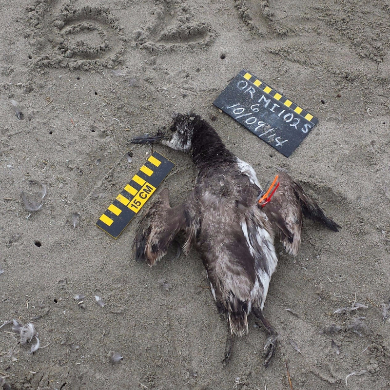
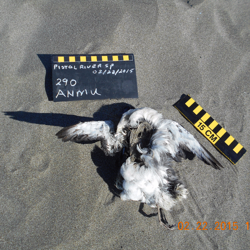
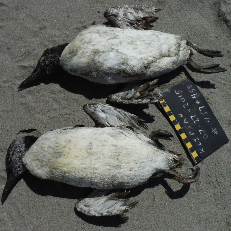
Wing measurements (L to R): 13 cm, 20 cm, 12 cm, 11 cm

Credits (L to R): Grant and Kathy (Oregon Mile 102), Marc and Craig (Oregon Mile 313 S), Teresa and Danny (Pistol River, OR), Joann and Julie (Klipsan Beach, WA)

It’s photo THREE that’s different here (Ancient Murrelet). The rest are adult Common Murres. Here’s why:

Feet are pale, not dark, and the secondaries do not have white tips. In photos one and four, all murres are in molt. Wings look “stumpy” like those of a juvenile, except the face of all these birds is mostly dark. Check out the feather wear of the bird in photo one. Even though the chin is dark, we know this can’t be a juvenile – juveniles have fresh, dark plumage all over – this bird has worn plumage except for the head and new (growing) primaries.

5cb6d54e-013f-4e1c-8880-91920b88aee2 be6628fd-984b-4210-8dc8-b88d17035cf4 Coasst150 bd3a84dd-e2f8-41fa-9344-f97364ca3926 (1)


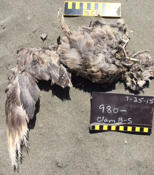
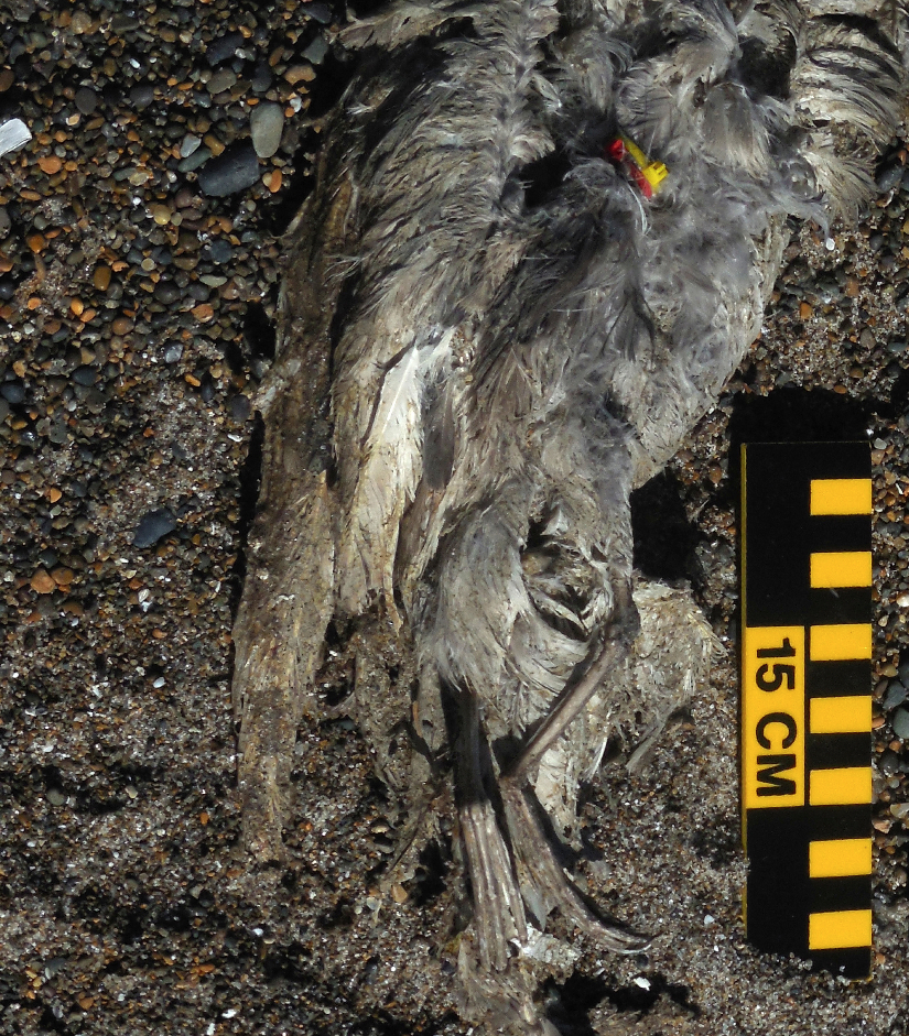
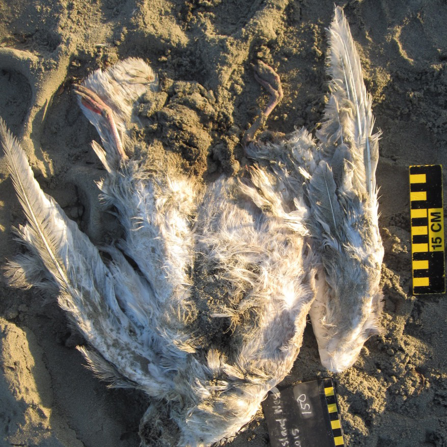
Wing measurements (L to R): 29 cm, 28 cm, 42 cm, N/A

Credits (L to R): Terry (Clam Beach South, CA), Steven and Nancy (Coronado Shores, OR) Ken (Sarichef East, AK), Deborah (Homer Spit Middle, AK).

It’s photo THREE that’s different. The rest are Northern Fulmars. Here’s why:
Although the plumage is similar, the wing measurement is WAY too big for a fulmar (28-33cm). Compare the heel (joint at base of toes) of the bird in photo two with photo three – that’s the swollen heel of a Larid, a Large Immature Gull.

78caac70-2cca-4fd3-b946-3e27b95bac09


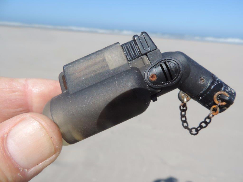
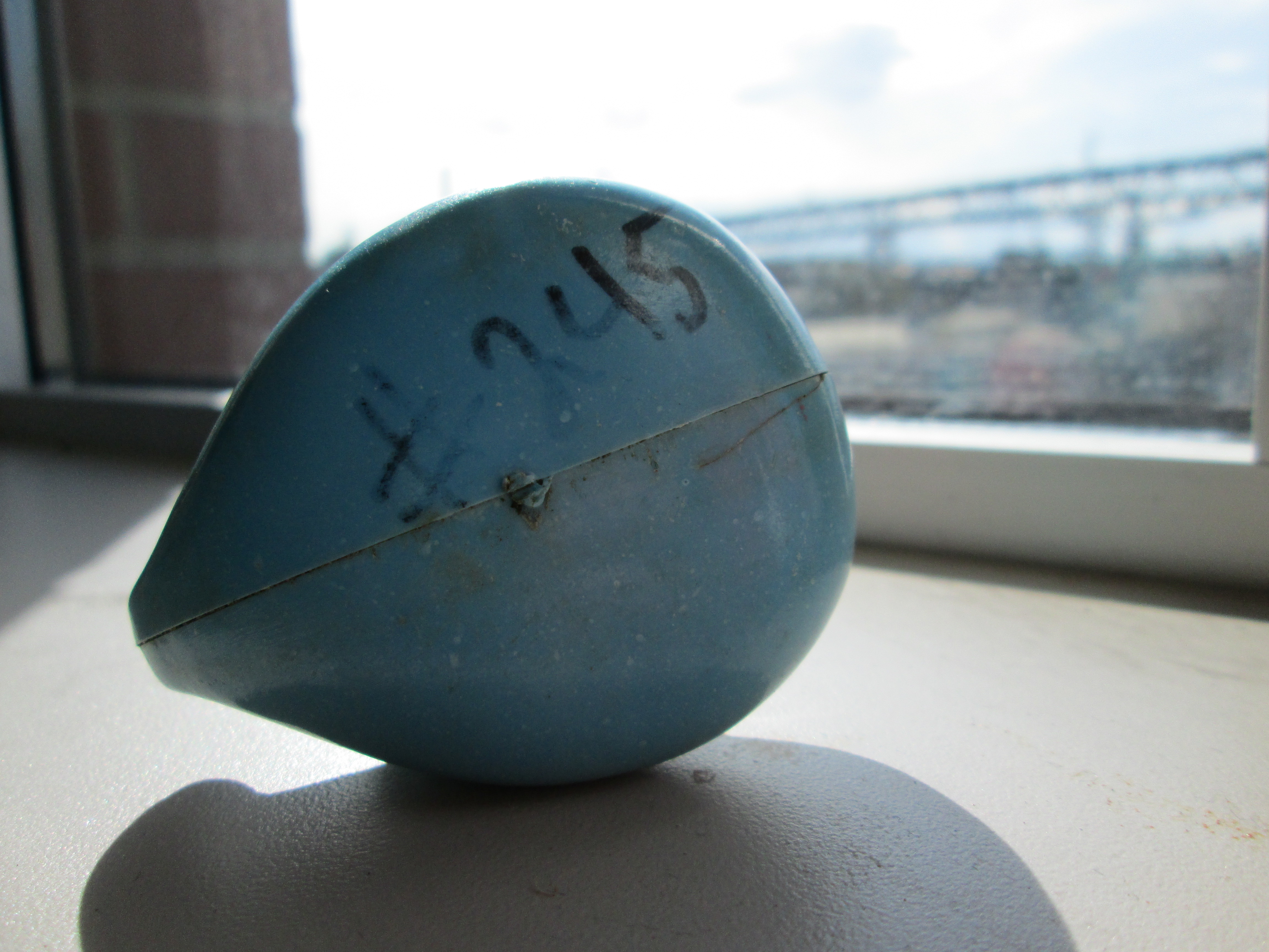
The mystery item from our last edition has been identified thanks to Ken and Art. As Art points out, “it is undoubtedly a butane powered micro brazing torch. Those things make great holiday gifts for the hard-to-buy-for crack or meth smoker, but they are also handy for electricians or mechanics with a need to heat something relatively small or delicate.”
5558a3ba-9950-4b73-8104-4af2c108acbe 7f50e230-0b8f-435a-b152-315561c79d28


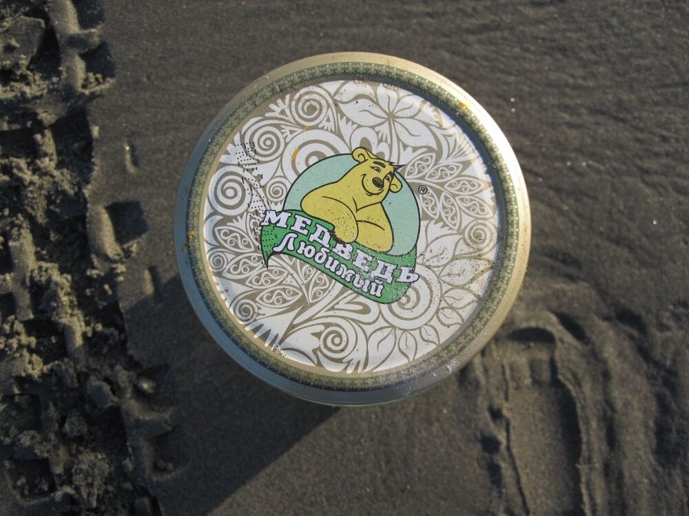
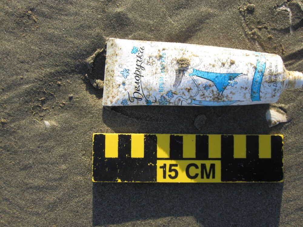
This week Ken from Shishmaref encountered a noteworthy concentration of objects with Russian and Korean writing. We are still in the process of translating the Korean, but in the meantime thought we’d share with you some of his finds.

Russian translation student Sarah identified that the jar is from brand Медведь любимый, translated as “favorite bear,” a company that cans fruits and vegetables.

The tube shown here contained hand lotion from brand Белоручка, which translates to “small white hands” or kid-glove.

eecf7252-9ad9-417b-8d59-beb171765cd8


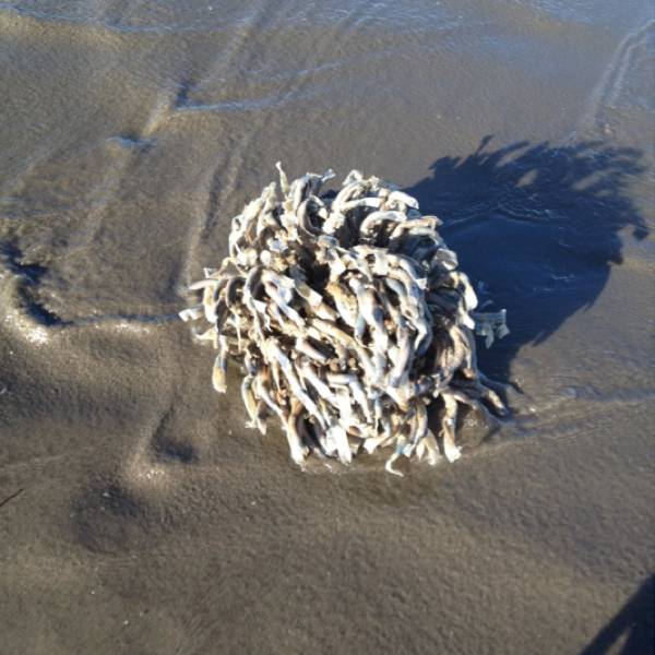
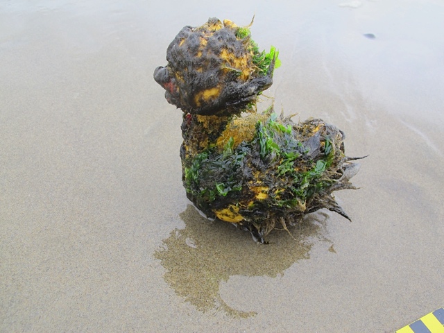
Check out the tubeworms that Keith found on his July survey in Ocean Shores (WA). Tubeworms anchor themselves to available substrates and secrete calcium carbonate, which forms the tubes that surround them. These tubes offer some protection from potential predators and other dangers. While there is still a lot to be researched about these unique animals, according to National Geographic, tubeworms have been around for at least 3 million years and can tell us a lot about the ocean’s history.

Seen something on the beach you’ve always wondered about? Send us a photo!

Cheers,
Erika, Julia, Jane, Hillary, Charlie, Heidi, Jenn, and the COASST Interns

What determines the path of marine debris through the ocean?

Physics! A combination of characteristics of the object, and the patterns of wind and ocean currents all play a role in where marine debris moves in the ocean. Why do we care? With two types of information–where debris winds up (on a COASSTER’s beach, for instance) and the influences of the movement of debris–we can determine where the object may have come from. This process can help to determine the sources of what’s washing in on our shores.

If we already know the source of marine debris and its beaching location, it can serve as a sort of “tracking device” or drifter. Following the devastating tsunami that struck Tohoku, Japan in 2011, models have been used to predict the path of the tons of debris that washed out to the ocean. The accuracy of these kinds of predictions depends on real, live information to verify and improve the methods.  COASST’s new marine debris program will collect this kind of data, taking into account the very characteristics of debris that play a part in how the object may move through the water.

Windage

Varying degrees of windage on example floats. Image originally appeared in NOAA Marine Debris documents about Tsunami Debris trajectories. http://marinedebris.noaa.gov/sites/default/files/Japan_Tsunami_Marine_Debris_Report.pdf

So how does it work? Ocean currents are important no matter what, but the influence of wind depends on characteristics like size, hollowness, dimensionality (is it flat?), and material (tells us about density). Obviously, hollow and less dense (buoyant) objects are likely to rest higher in the water than solid or heavy objects. The shape and volume of any hollow cavity influence how a floating object is affected by wind. The area of the object that sticks above the water, or “sail area” determines the degree that wind impacts the object’s movement. This is known as “windage”. High windage– where the majority of the object is above the surface of the water–results in an increase of wind force on the sail area, where wind patterns in addition to ocean currents play a role in the path. Just as it sounds, the sail area acts as a sail and catches the air current. Oppositely, the “drag area” is the part of the object that lies below the surface. For objects that are flat or float just below the surface, windage will be very low.

One outcome of drifting debris

Gyre

North pacific Subtropical Convergence Zone, courtesy of wikimedia commons

You may have heard of the North Pacific Gyre (NPG): a slow-moving spiral of converging ocean currents created by a high-pressure system of air currents. Within this convergence zone lies what is known as the Great Pacific Garbage Patch; millions of pounds of trash and plastic that extend for miles below and across the surface of the ocean. The massive accumulation of garbage comes from all over and is carried to the NPG by those very currents that converge there. Every piece of plastic that forms the “garbage island” got there by the forces of ocean and air currents. Objects with higher windage, tend not to accumulate in the Garbage Patch, as the wind sends them on their way.


Lucky Duck #245

Over spring break, marine debris student intern, Abby, spent the day hunting for petroglyphs and marine debris on the three-mile stretch of beach from Cape Alava to Sand Point.

By far the most interesting find was a weathered blue plastic duck, found among some seaweed in the wrack, with a large sharpie-marked “#245” on the bottom of it. Abby guessed it might have been a part of some project, so she brought it back to the COASST office to investigate. 

Blue Duck Profile

Maybe #245 is its race number and this little guy made it a lot farther than the finish line.

Was #245 its race number and this guy made it a lot farther than the finish line?

Curtis Ebbesmeyer, a local oceanographer whose work revolves around modeling ocean currents, popularized the use of marine debris as a type of tracking movement of water on the ocean surface. He got his start after a large shipment of 29,000 plastic “Friendly Floatees” bath toys were dumped into the Pacific Ocean in 1992 and for the next 15 years or so people were finding toys from this specific spill washing up on beaches all over the world.

Photo credit A. Larson. Another example of a beached duck. You won't find this guy in the COASST field guide.

Photo credit A. Larson. Another example of a beached duck, but you won’t find this guy in the COASST field guide!

Picking up on this idea, schools, cities, and various non-profit organizations have taken to releasing batches of rubber ducks into streams and oceans, and relying on helpful beachcombers to report where and when they’re found. While COASST won’t be releasing any ducks or wood blocks (the slightly more eco-friendly version), future marine debris participants will collect information on where and when an object was found, material size, markings and identity to provide insight into source and movement patterns for all debris.

As to the little blue duck? After some CSI sleuthing on Google we found a “vintage” duck of the same style for sale on Etsy. Heidi did mention the Annual Great Olympic Peninsula Duck Derby, a good and local contender, but recent releases feature classic, yellow ducks. Finally, a potential match – could it be from the San Clemente (CA) Ocean Festival, about 1,740 kilometers south of the spot Abby found it on the North Coast of Washington?

IMG_0015

IMG_0022

Adventures in Marine Debris

This winter, COASST marine debris student interns embarked on several field trips across Washington to develop and refine a preliminary protocol for the new marine debris program. Interns this quarter included a photo team, Abby and Jessica, and a field team, Angeline and Kaili.

Reports from the field:

A total of 14 beaches so far, from Deception Pass to Ocean Shores! Discovery Park was our first stop, to trial the small debris survey methods – lots of beach glass at both this site and Alki Beach.

 Interns Kaili and Abby survey for small marine debris at Discovery Park

Kaili (left) and Abby (right) use a 1 meter quadrat (i.e. square) to define the search area for small marine debris at Discovery Park (Seattle).

Together with service learning students Christie and Yi, we visited Whidbey Island beaches Ala spit, Penn Cove, Joseph Whidbey State Park, Fort Casey, and Useless Bay. The physical differences between these five sites was quite surprising (substrate, wood, wrack, bluff, dunes, exposure) given they’re all within a few kilometers of each other. Special thanks to COASSTers David and Candace, who oriented us to their beaches and shared some (much needed) chocolate!

Service learning student Christie paces the width of the beach.

Christie paces the width of the beach on a medium debris transect at Penn Cove (Whidey Island).

From the Puget Sound, we ventured to Ocean Shores to check out North Jetty and South Taurus beaches. Super wide, sandy beaches made the marine debris surveys much slower than those in Puget Sound.

The following week we returned to Ocean Shores to survey Damon Point and North Jetty to see if debris had shifted/accumulated/changed. We also visited the annual Beachcombers’ Fun Fair where we saw Heidi (COASST staff), and other marine debris enthusiasts, Curtis Ebbesmeyer and Alan Rammer. The collections and displays at the festival (that’s right, 44 exhibit categories, including “assembled unadorned pieces of driftwood”) helped us identify many objects we’ve been seeing in COASSTer photos and on our beach surveys!

Out at Damon Point, we almost lost our small debris surveyors (and equipment!) to a rogue wave. For the rest of the trip, we trekked all the way around the perimeter of Damon Point looking for particularly complex/interesting items to add to our marine debris teaching collection. Where did we find the most stuff? At the very tip! (fingers/points/spits tend to snag debris and birds – just ask the folks at Ediz Hook or Dungeness Spit).

During spring and summer quarters, we’ll continue to test and refine the marine debris monitoring protocol, getting it ready for Prime Time!

Angeline, Abby and Kaili enjoy the view at South Jetty after a long day of marine debris monitoring.

Angeline, Abby and Kaili (left to right) celebrate on the northern edge of Gray Harbor (Ocean Shores) after a long winter’s day of marine debris monitoring (shoes not required).

Using marine debris photos

Karen (left), Abby (middle), and COASST Data Verifier Charlie (far right), assess marine debris objects during a survey refinement session where we asked the question: do Karen, Abby and Charlie agree on the characteristics of each object?

Students Karen (left), Abby (middle), and COASST staff member Charlie (right), assess marine debris objects during a survey refinement session where we asked the question: do Karen, Abby and Charlie agree on the characteristics of each object?

Thanks to a recent award from the National Science Foundation Advancing Informal STEM Learning (AISL), COASST is expanding to monitor marine debris. Since December, we’ve assembled a team of student interns and staff dedicated to developing this new program lead by Marine Debris Program Coordinator Hillary Burgess. What have they been up to? Creating a scientific protocol for monitoring debris that collects information useful to the resource management community AND is do-able by COASSTers.

Like the beached bird program, marine debris COASSTers will document basic beach and human use data (wood, wrack, humans, dogs and vehicles) and for this program, the quantity and characteristics of debris objects. These data link to how harmful debris are to wildlife and wildlife habitat, where debris comes from (some obvious, some we haven’t thought much about), and the path debris take to get to the beach.

Thanks to the dedicated effort of hundreds COASSTers, the marine debris team hit the ground running and began analyzing a database of over 6,000 marine debris photos from about 200 beach sites in the Pacific Northwest and Alaska. Photo team interns Jessica and Abby are independently assigning characteristics to debris objects – so far, they’ve reviewed nearly 900 photos! Pausing along the way to compare results, analyze sources of disagreement, and make adjustments accordingly, these photos have been extremely valuable in the creation of the new survey.

Beyond photos, we’ve also launched an expert panel to help determine which types of characteristics should be included: bite marks? color? weathered? Although it may sound fairly straightforward, marine debris comes in a seemingly infinite array of shapes, hues, materials, and sizes – dealing with the challenging variability has led to many hours of debate and discussion.

And lengthy discussion does sometimes lead to more lighthearted moments and philosophical consideration of debris. For instance, is the object a loop? Some objects have very small holes; other objects are rope/line tangled into a massive ball of loops. And why do we care? Loops can be super dangerous to marine organisms, causing entanglement and strangling, a threat especially well documented in Northern Fur Seal pups. All this talk prompted Hillary to look up the actual definition of a loop online. We pondered: if the end is connected to the beginning, what is the beginning or the end?

Stay tuned for more updates from Hillary and marine debris program students – we’re rapidly making progress toward the 2015 launch of marine debris surveys!

High school students return tsunami boat to Japan

The west coast of the United States has been the final resting place for much of the wreckage that left Japan on March 11, 2011, after a massive earthquake and resulting tsunami rocked its shores. One such relic of the tragedy is a small fishing boat belonging to a Japanese high school in Rikuzentakata that washed ashore in Crescent City, California this past April. This boat survived an incredible journey across the planet’s largest ocean.

Students from Crescent City’s Del Monte High School made it their mission to return the boat to Japan free of barnacles and full of compassion. These students understand the devastation a tsunami can cause, as they too were impacted by the event. The earthquake that created the Japanese tsunami also caused a tsunami that badly damaged Crescent City’s harbor. The Del Monte students filmed a video that shows the connection these two cities share. They sent the video with the vessel as a reminder to the students in Rikusentakata that they have not been forgotten and that a midst the unthinkable devastation and loss, there can be small but meaningful steps toward healing. After two years awash at sea, the boat departed Oakland for Japan on September 19th, to be reunited with its rightful owners at last.

Students from Del Norte High School return the boat to Japan with compassion.

Students from Del Norte High School return the boat to Japan with compassion.

Click here to learn more about this project and see the student’s film.