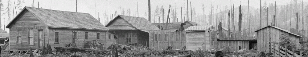
At the end of the 2016 field season (see Parts One and Two of our posts on pedestrian survey), Hollis and I set up a grid for surface collection on an artifact scatter in the northeastern-most area of the site. Surface collection is a tried-and-true method of identifying archaeological sites and areas-of-interest in historical archaeology. Very often, much of what we are interested in historical archaeology it is on, near, or predicted by what is on the surface. This is particularly true here, where the site isn’t very old and there is probably not a lot of dirt being deposited on the ground over time. Our goal for this surface collection was to get a sample of artifacts from the site. We could use this sample to justify future funding, as well as to plan out our laboratory analysis techniques (for when we recover more artifacts!).
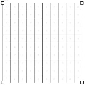
Figure 1: Scan of our field forms showing an idealized grid. Scan by David Carlson.
Our surface collection strategy involved setting up a 2-meter grid in a 20- by 20-meter area. This gives us 100 quadrats, or grid squares, to investigate (Figures 1 and 2). Each square is given a unique identifier, so we can make sure to keep all artifacts we find in it together. There are two reasons for picking this method. First, it means we don’t have to decide what to point plot. One way of collecting surface material is to take a GPS or total station and record either every artifact you find, or centerpoints for collections of artifacts. Recording every artifact is time consuming, given that most are going to be small fragments. It also means you either have to use a total station or a really good GPS unit, as most GPS units will not have enough precision for what you want. Recording clusters of artifacts is easier, but more arbitrary (how do you define a cluster?) and is difficult to visualize and analyze in a GIS. By collecting everything within a quadrat, we avoid dealing with some of these issues.
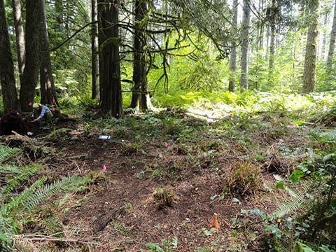
Figure 2. Gridded and cleared area of surface collection. Photo by David Carlson.
Second, it lets us systematically clear the surface. For each square, we scraped the surface with trowels and 1/8″ screened the surface debris. We scraped the surface to clear away mold, tree and root debris, and loose material. Once we could see dirt (or humus), we stopped (Figure 3). The reason for this is that much of the site is covered not only in living plants, but in not-yet-decayed plant remains. So even if you clear all plant growth (which we also did), your surface artifacts may still be obscured by recent plant matter. Setting up grid squares allowed us to systematically clear each square in its entirety, revealing a great deal more material than we would have found otherwise and giving us a better estimate of the below-surface distribution of artifacts. It also meant that when we screened the material we cleared (to find any small artifacts caught up in it), we knew where in space the screened material came from and had control over how we collected it.
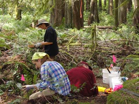
Figure 3. Hollis Miller, Sam Hordeski, and Joyce LeCompte-Mastenbrook help clear a quadrat. Photo by David Carlson. Please contact David before using, reproducing, or altering this image.
This survey took a week or so’s worth of time, but was extremely valuable in both confirming the date of the site and in justifying future research. I may post more about the results of this collection in the future, as long as I can figure out a way to do so without talking too much about the artifacts we found (see the FAQ for further explanation).