June 21, 2022
How UW Students Use GIS in their Research
Near the end of the academic year, UW Libraries virtually hosted the 6th annual GIS Symposium. The GIS Symposium highlights and celebrates the transformational role of Geographic Information Systems (GIS), remote sensing, and data visualization technologies at the UW and beyond. While there are other GIS-focused events on campus, the UW Libraries’ GIS Symposium features interdisciplinary presentations open to all departments at the university.
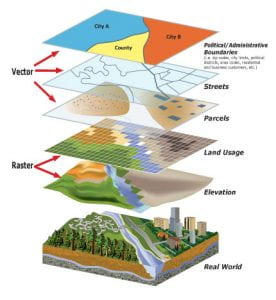
To those unfamiliar with GIS, UW Libraries Global Studies and Geography Librarian Kian Flynn describes it as “a system featuring geographic data that can be used to store, analyze, and visualize (often in the form of a map) that data.” GIS can be used in everything from urban planning to agriculture analysis, to telecom/network services optimization.
At UW, students across all disciplines learn how to use GIS resources in their research, and the GIS Symposium presents an opportunity to showcase their impressive work.
The schedule of the GIS Symposium featured a keynote speaker and short talks given by undergraduate students, graduate students, and faculty. This year, UW Bothell faculty Jin-Kyu Jung and Nora Kenworthy gave the keynote lecture, GoFundUS: A Critical and Creative GIS and Geovisualization Project to Unmap and Understand Inequalities in Medical Crowdfunding. This year’s contributors to the short talks come from all over the University and this year’s symposium featured work from the Seattle and Bothell campuses, as well as the Geography, Earth and Space Sciences, Human-Centered Design & Engineering (HCDE), History, French & Italian Studies, and Environmental Science & Resource Management departments.
This year’s contributors to the short talks come from all over the University.
At the 2022 GIS Symposium, topics covered an impressive range of content, all of which highlighted the crucial role that GIS plays in research at UW. Below is a list of the short talk topics given at the presentation:
Brett Halperin — Interactive Digital Story Mapping to Document Housing (In)justice through Community-Based Design
Graduate Student, Human-Centered Design & Engineering
Anna Nguyen and Madison Heslop — Entanglements: Counter-Mapping the History of Asian Migration onto Coast Salish Lands
Graduate Students, History
Maya Smith — “Reclaiming Venus” through ArcGIS Story Maps
Faculty Member, French and Italian
Natalie Vaughan-Wynn — The Uneven Geographies of Digital Food Apartheid
Graduate Student, Geography
Xiaohan Yao — Earthquakes’ Influence on Populations and Land Cover in King County with GIS
Undergraduate Student, Earth and Space Sciences
Jessie Woldstad — Snow Coverage on Mount Rainier: 2001 vs. 2021
Undergraduate Student, Geography: Data Science
Mike Lang and Elizabeth Davis — The Disaster Response Exercise: Mapping a Post-Earthquake Environment from a Bicyclist’s Perspective
Undergraduate Student, Environmental Science & Resource Management and Graduate Student, Earth & Space Sciences
The UW Libraries GIS Symposium and the Proceedings of the GIS Symposium that will be published on the Manifold platform are both open and accessible to the general public. Through the Symposium, the Libraries provide a platform for students to present their projects and gain valuable presentation skills in front of an interdisciplinary audience. The Symposium provides a platform for the UW GIS community to work across disciplinary silos and learn from their colleagues in different disciplines.
To learn more about how to get involved in GIS work at UW Libraries, or about future GIS events, visit the UW Libraries GIS resource guide or the libraries’ calendar.
