August 5, 2020
Forecast: August 5th, 2020
By Calen Randall
Hey Huskies,
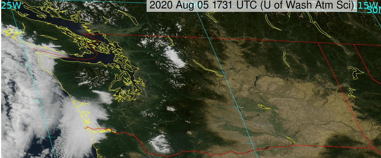
The I-5 corridor is devoid of cloud cover this morning, but marine layer clouds have filtered in along the coast. For those in the Puget Sound lowlands, enjoy the sunny weather today and get ready for this picture to change overnight as a cloudy trough is headed towards the Pacific Northwest.
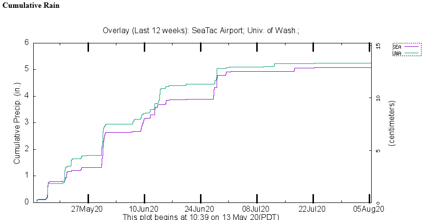
The incoming trough is expected to bring rain to western Washington, a phenomenon Seattle has barely seen since June. In the graphic below, you can see just how dry the past month has been. From mid-May to the end of June the University of Washington campus received nearly 5 inches of rain. However, since the start of July, our cumulative precipitation totals have barely budged!
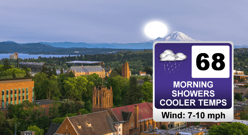
If you are a fan of the warm weather, you should get outside and enjoy the temperatures in the high 70s to low 80s today. Temperatures about ten degrees colder in the mid 60s to low 70s will accompany the rain tomorrow. Under a tenth of inch of rain is likely for south King and Pierce Counties, while Snohomish and Skagit Counties could see up to a third of an inch of rain overnight. Seattle totals should fall between a tenth and a quarter of an inch.
A Fire Weather Watch has been issued in much of central Washington for tomorrow afternoon. Breezy winds above 20 mph coupled with dry conditions could lead to swift fire development and spread. If you live or are traveling in the Okanogan Valley, Columbia Gorge, or Wenatchee foothills areas, please be cautious and check weather and fire alerts!
Reach forecaster Calen Randall at theuwdawgcast@uw.edu. Twitter: @Wx19Calen.
| SATELLITE | TOMORROW’S FORECAST |
|
 |
