October 9, 2020
Forecast: October 9th, 2020
By Matthew Charchenko
While we started off the first full week of fall quarter with calm weather and some warm sunshine, the second weekend of the quarter wont be sharing those characteristics. We are waking up to cloudy skies this morning in Seattle, and those clouds will stick with us during the day. While we will make it through most of Friday without rainfall in Seattle, those raindrops will start to fall on campus Friday night.
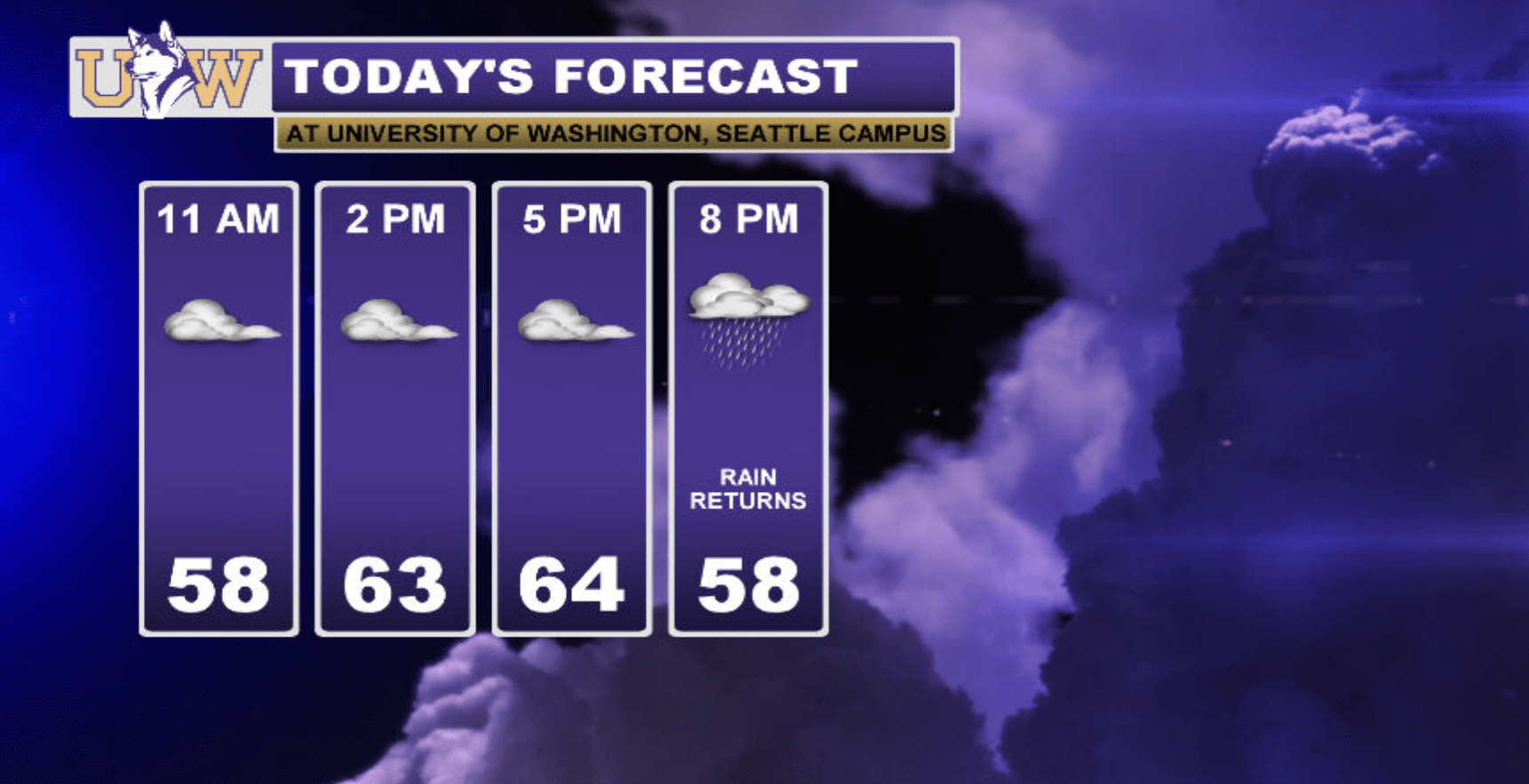
Right now a cold front is sitting off of the coast and will start to push its way inland this evening. If you have to run any errands after classes you won’t need to worry about bringing a raincoat, but that rainfall will begin on campus around 9-10pm. It will be a perfect night to light those fall scented candles and curl up with a good book while listening to that cozy Seattle rainfall!
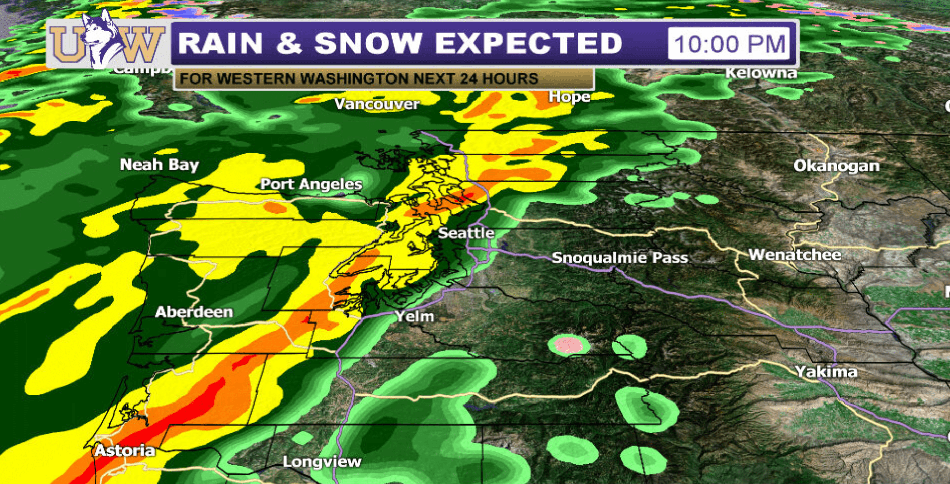
That steady frontal rainfall from Friday night will start to make its way out of the area by Saturday morning, and we will be left with that mixed bag of showers and sunbreaks. We will be working with some instability in the atmosphere during the day on Saturday, so don’t be surprised if you hear an isolated rumble of thunder or get caught in a downpour if you’re out and about.
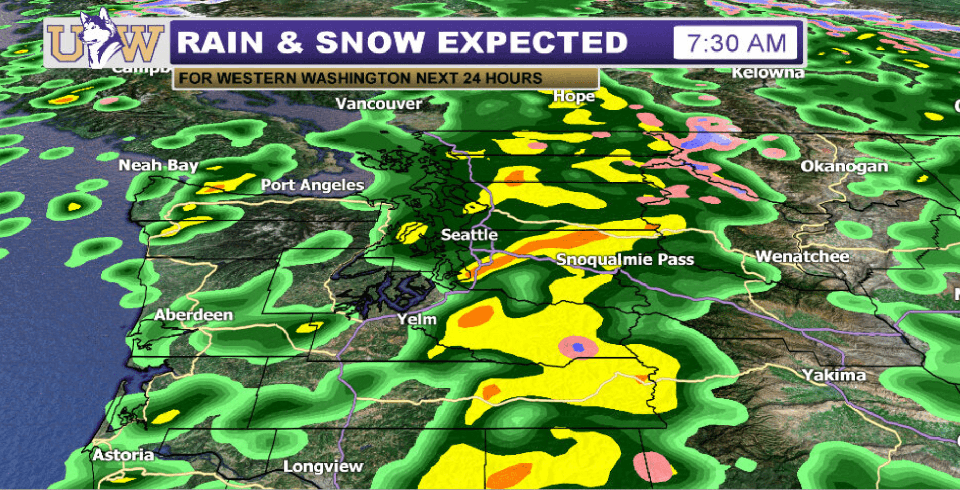
We will still be dealing with lingering showers during the day on Sunday, but they will be less frequent than Saturday. So if you have to schedule any outdoor plans this weekend, Sunday will be the better day to get outside this weekend.

Another weak weather system moves through the area Sunday night into Monday, so expect to see some lingering showers during the day on Monday.
Reach forecaster Matthew Charchenko at theuwdawgcast@uw.edu. Twitter: @mcharchenko.
| FUTURECAST TONIGHT | WEEKEND PLANNER |
|
|
