October 12, 2020
Forecast: October 12th, 2020
By Anthony Edwards
Happy Monday, Huskies!
Following our first windstorm of the season last night, today will be much calmer.
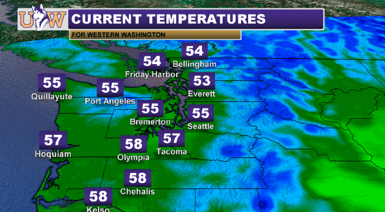
A weak Puget Sound Convergence Zone has been hanging on throughout the central Sound this morning, bringing some light precipitation and cloud cover to Seattle.
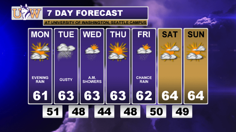
By this afternoon, the sun should peak out, as temperatures try and surpass 60 degrees. The sun won’t last long, though, as another system moves into the region after sunset. Moderate rain and winds will accompany this weather-maker. Most of western Washington will see a quarter to a half-inch of rainfall before tomorrow morning, as higher amounts should fall in the mountains.
Strong winds will follow in the wake of the system, with gusts approaching 25 miles per hour around Seattle, and approaching 40 miles per hour from Snohomish County towards the B.C. border. A few thundershowers are also possible Tuesday afternoon. Temperatures will be seasonal in the low-to-mid 60s.
We will mainly dry out for the rest of the week following some light rainfall on Wednesday in the wake of the system, with temperatures hovering in the low 60s and lows in the upper 40s for Wednesday, Thursday, and Friday. A slight chance of rainfall Friday, but it shouldn’t amount to much.
The upcoming weekend looks much nicer than the past, as temperatures should be in the low-to-mid 60s and we should remain relatively dry!
Have a great week.
Reach forecaster Anthony Edwards at theuwdawgcast@uw.edu. Twitter: @edwardsanthonyb.
| CURRENT TEMPERATURES | 7 DAY FORECAST |
 |
 |
