October 13, 2020
Forecast: October 13th, 2020
By Matthew Charchenko
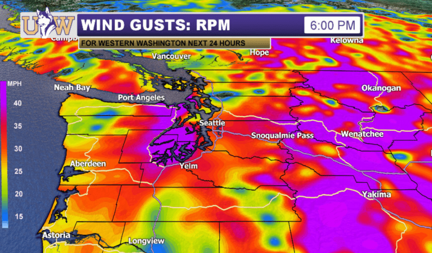
Good Morning Huskies! We are in for a gusty day on campus thanks to a strong area of low pressure that is currently moving into British Columbia. Winds right now are steady between 10-25mph around Puget Sound, and will continue to increase throughout the day.

The cold front associated with this area of low pressure moved through earlier this morning, bringing some thunder and lightning to the south sound. Steady rain this morning will be replaced with a mixed bag of weather due to an cold pool of unstable air behind the front. Expect a combination of showers, sunbreaks, and a few isolated thunderstorms through the afternoon hours.

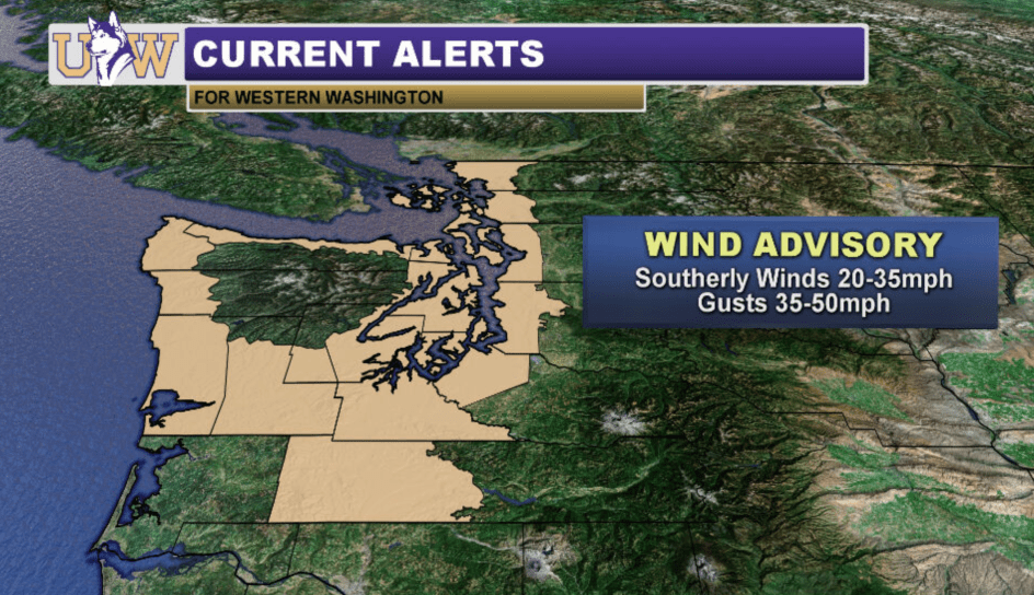
Gusty winds are the main story today, prompting the National Weather Service in Seattle to issue our first wind advisory of the storm season. Gusts in Seattle will generally range from 35-45mph, with stronger winds possible the further north you go. Power outages today could impact any online classes, especially this afternoon when winds are expected to peak. So be sure to keep your devices charged!
Winds will continue to increase through the rest of the morning, with the strongest winds occurring between 12-6pm.
Stay tuned to our social media accounts for storm updates throughout the day!
Reach forecaster Matthew Charchenko at theuwdawgcast@uw.edu. Twitter: @mcharchenko.
| FUTURECAST: WIND GUSTS | CURRENT ALERTS |
|
|
