October 14, 2020
Forecast: October 14th, 2020
By Calen Randall
Hey Huskies,
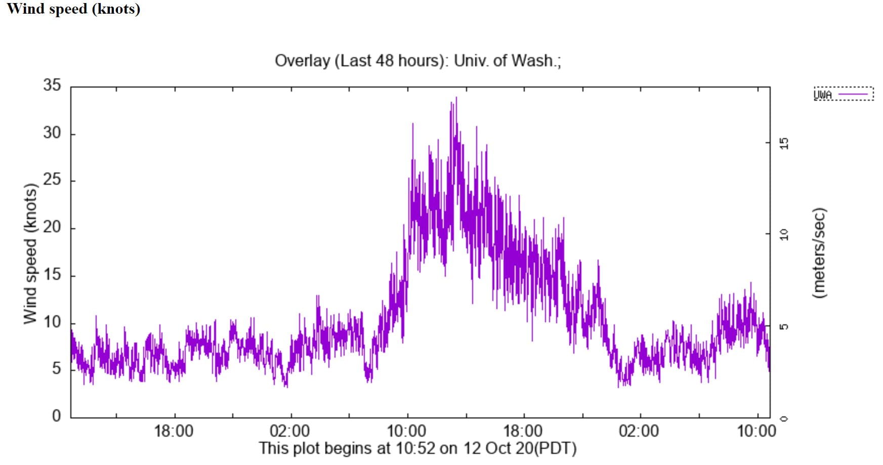
Early yesterday morning, a cold front rumbled through, dropping a half inch of rain on campus. Alarm clocks were not necessary in the south Sound yesterday; the thunder rattling the walls was as good as any wake-up call! While the frontal downpours and thunder were impressive, the big story was the wind that arrived after the front and left over 120,000 Puget Sound residents without power. Seattle may not be the “Windy City”, but its peak wind speeds yesterday eclipsed those in blustery Chicago! Gusts in the 35-50 mph range were recorded in many locations around metro Seattle. Winds on campus peaked at about 40 mph (35 knots).
After yesterday’s turbulent weather, the atmosphere is far calmer today. Morning convergence zone action brought showers to Snohomish County, but outside of scattered showers, the weather should be dry for the rest of today. Partially cloudy skies with plenty of sunbreaks are expected, perfect for a walk. Winds will be far calmer, with most gusts only reaching the mid teens.

Fall temperatures have taken hold, with highs in the low 60s and upper 50s dominating the forecast. Cool lows in the mid-to-upper 40s will persist through the week. Fog is likely tomorrow morning, but outside of some low clouds, the skies should be clear in early afternoon. Another system of wet weather will arrive on Friday, though outside of a chance for scattered showers, the weather should be mostly dry on the weekend.

Enjoy the less turbulent weather today!
Reach forecaster Calen Randall at theuwdawgcast@uw.edu. Twitter: @Wx19Calen.
| 7-DAY FORECAST | CURRENT WINDS |
|
|
