January 29, 2023
Forecast: January 29th, 2023
Last updated 1:00 PM, Sunday, January 29th, 2023
By Jared McGlothlin
Good afternoon Huskies!
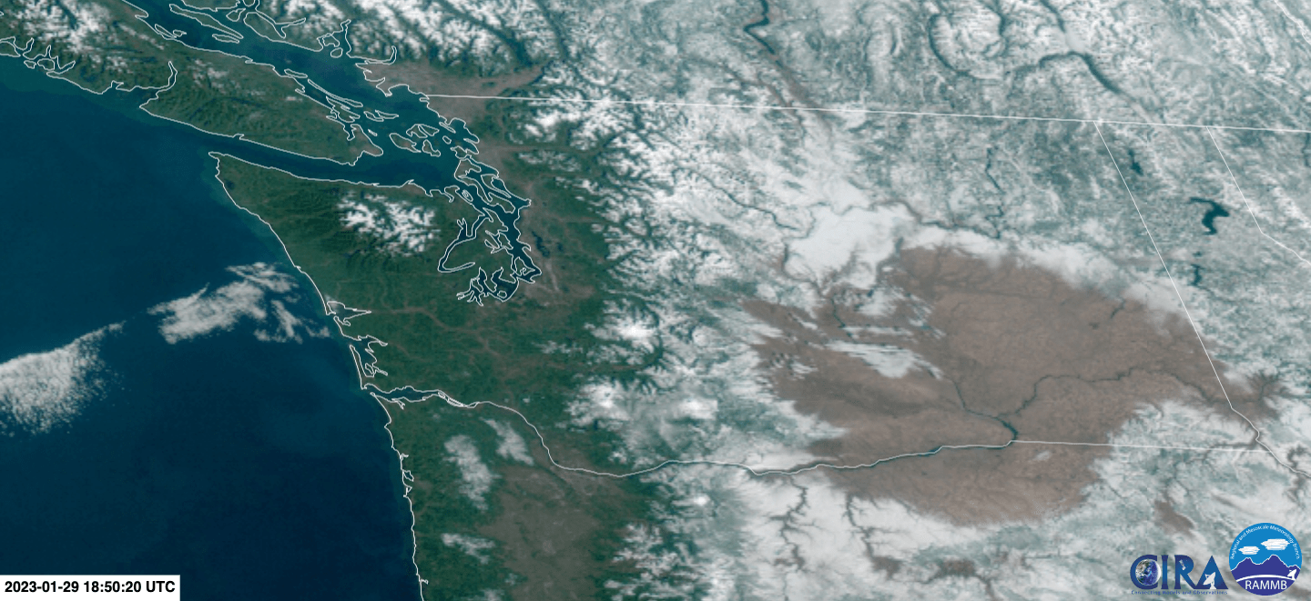
The mountain is out today! The cold, dry air mass that came in last night has given us a much needed dose of clear skies and good visibility. Western Washington is currently (almost) entirely cloud free!

Webcams from around the region are showing some views that almost look like summer (if you ignore the snow on Mt Rainier).
Current temperatures are in the upper 30s for most of the Puget Lowlands and the coast. Below freezing temperatures are present in the passes, but significant precipitation is not expected so traveling should be unaffected.

Conditions are expected to remain cold, dry, and clear through Tuesday morning. While it is too dry for any lowland snow, there is some frost sticking around in places, and icy roads are possible in wet shady areas.
Looking later in the week, the current offshore ridge giving us clear skies will start to break down on Tuesday and a weak warm front will come into the region Wednesday bringing clouds and a chance of precipitation (primarily for the North Sound and the peninsula). Following that, we will shift back to our typical winter weather pattern, with cloudy skies and rain returning in time for the weekend.

Get outside and enjoy the sunshine while it lasts!
Reach forecaster Jared McGlothlin at theuwdawgcast@uw.edu or on Twitter @TheUWDawgcast and Instagram @UWDawgcast

Recent Comments