August 7, 2020
Forecast: August 7th, 2020
By Dylan Logan
Good morning, Huskies!
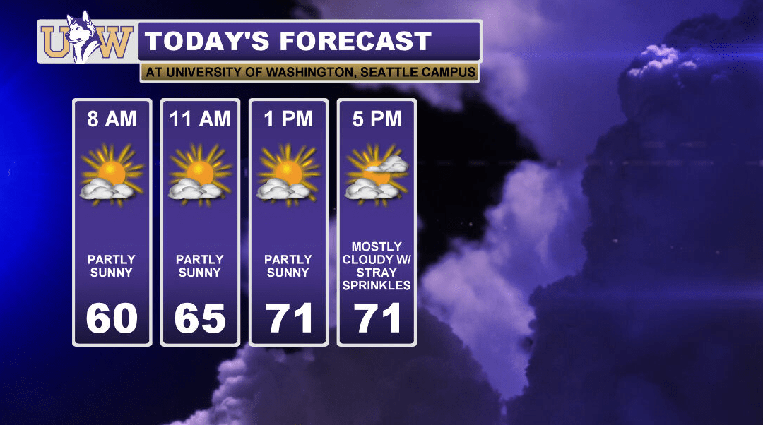
We are waking up to more spotty skies and cool temperatures this Friday. Those who enjoyed the relief from the summer heat and sun yesterday will enjoy it once again today! Clouds will increase throughout the day, eventually leading to mostly cloudy to overcast skies by the early evening. With the increase in clouds, expect the very slight chance of a quick drizzle before and around sunset. Some showers remain possible overnight, but the likelihood remains low. If any do develop, they will likely be light and brief.

A gentle wave of summer weather returns to the sound tomorrow with less clouds and slightly warmer temperatures. By Sunday, high temperatures will rest around 80 with clear skies. This warmup is light in comparison to heat ups earlier this summer, as temperatures will likely peak out on Monday with a high in the low to mid 80s. Going into the middle of next week, sub-80 temperatures may return, along with some clouds and passing showers.
Thankfully, it has been a quiet wildfire season in Washington State. We are slowly exiting what is climatologically the driest and warmest time of the year. With temperatures remaining near average, and with the aid of the occasional spurt of rain this past week and next week, the wildfire risk remains relatively low for the foreseeable future.
Enjoy your weekend, Huskies!
Reach forecaster Dylan Logan at theuwdawgcast@uw.edu. Twitter: @DylanLogan33.
| TODAY’S FORECAST | GEOPOTENTIAL HEIGHTS |
 |
 |
