October 22, 2020
Forecast: October 22nd, 2020
By Rachael Fewkes
Hey, Huskies!
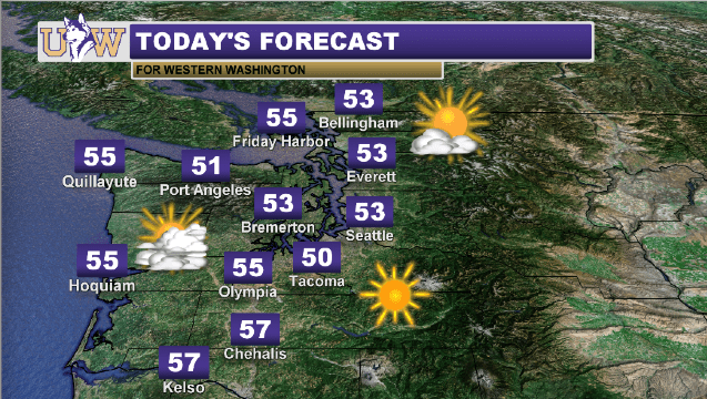
If you’ve stepped foot outside this morning, you may have noticed it felt especially brisk out there. For most of Western Washington, temperatures dropped all the way into the upper 30s and low 40s overnight, and we’re only going to see it get colder over the next several days.
Today you can expect morning clouds to give way to crisp, clear conditions this afternoon making for a picture-perfect autumn day! It won’t exactly be warm with highs around the region maxing out at just over 50 degrees, but it will certainly be beautiful regardless.
Tomorrow is when we’ll really see a significant change in the weather pattern as cold air from the north infiltrating the entirety of our state. In addition, a low-pressure system will be moving in from the Pacific, packing abundant precipitation along with it.
Said precipitation will come in the form of snow at elevations above 2000’, so a Winter Storm Watch is currently in place over the Cascades. Anywhere from a couple inches to nearly a foot of snow will fall throughout the course of the day on Friday, which will make for difficult traveling over mountain passes. If you’re planning on heading over the mountains on Friday or during the weekend, be sure to stay updated on pass forecasts. You can check Washington mountain pass conditions here: https://www.wsdot.com/traffic/passes/.
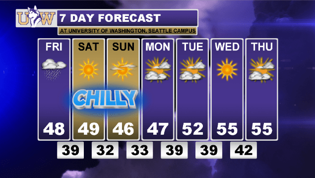
As we move into Saturday, we’ll see the sunshine return, although the chilly temperatures are forecasted to stick around until mid-next week! Highs will hover around the mid 40s throughout the Puget Sound, and lows will dip just below freezing.
Bundle up, stay warm, and have a wonderful rest of the week!
Reach forecaster Rachael Fewkes at theuwdawgcast@uw.edu. Twitter: @rachaelfewkes.
| WEATHER HEADLINES | 7-DAY FORECAST |
 |
|
