Category Archives: Blog – research

USGS collaboration: Astoria Canyon sediment core processing

As a part of the USGS-UW Cascadia Canyons project, the sediment dynamics group recently traveled down to the USGS Pacific Coastal and Marine Science Center in sunny Santa Cruz for one week of sediment core processing. The cores on the “operating table” this week were 9-meter-long jumbo piston cores collected from the muddy floor of Astoria Canyon between 700 and 1500 m water depth. The complete core processing workflow included CT density scanning, core splitting, photography and subsampling. Once our work was complete, we sealed cores into airtight tubes to be archived in a USGS core repository.

These cores are among the longest sediment records collected from this region of Astoria Canyon, and they have already given us valuable insight into canyon mass transport events (turbidity currents and debris flows) during Holocene sea level highstand. A primary feature of these cores are the turbidite deposits that vary in lithology, thickness, age and frequency from core to core. While the canyon was once thought to rarely experience mass transport during Holocene highstand, this new evidence indicates that several transport events have occurred within the last 300 years.
Fun in False Bay

Mariah Josten has contributed this post about her work this Autumn, as a Research Apprentice at Friday Harbor Labs

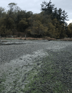
False Bay at low tide (credit: MJ)

I spent fall quarter at Friday Harbor Labs conducting an independent research project in the False Bay estuary, on San Juan Island. This bay is super unique because at high tide it’s covered completely by water and during a very low tide, the bay empties and reveals a tide flat brimming with benthic organisms, rotting sea lettuce, and a wide range of sediment grain sizes. The goal of my project was to examine how waves coming through the narrow bay entrance and sediment input from False Bay Creek combine to shape the grain size distribution in False Bay. To do this I collected 52 sediment samples by hand (mostly in the middle of the night) along two transects from shore towards the middle of the bay.

Grain size results

The “delta” transect crossed the intertidal delta created by False Bay Creek and continued into the bay to examine the influence of creek sediment transport. A “tideflat” transect, 250 m away from the creek delta, examined wave influence on grain size. The tideflat transect revealed that at the shore, the there was equal amounts of medium and fine sand and the fraction of medium sand increased towards the middle of the bay. The delta transect began with poorly sorted sandy gravel near the shore and converged in character with the tideflat transect beyond the edge of the delta. Overall, my results suggest that outside the delta itself, wave energy dominates sediment characteristics for the rest of the bay.

False Bay Creek delta and channel

Hot off the press

Check out our brand new publication in the Journal of Geophysical Research: Earth Surface about sediment dynamics in the Ayeyarwardy Delta!

Glover, H. E., Ogston, A. S., Fricke, A. T., Nittrouer, C. A., Aung, C., Naing, T., et al. (2021). Connecting sediment retention to distributary channel hydrodynamics and sediment dynamics in a tide-dominated delta: The Ayeyarwady Delta, Myanmar. Journal of Geophysical Research: Earth Surface, 126, e2020JF005882. https://doi.org/10.1029/2020JF005882

And please get in touch if you can’t access the article and would like to read it (hglover@uw.edu).

Sampling along the Bogale River in Sept 2017

MSP Is Back!

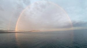
Rainbow over the Elwha! (Photo credit: C. Williams)

The Marine Sedimentary Processes Research Apprenticeship headed back to the Elwha River last week. In this class, students develop their own research questions related to the Elwha dam removal project, collect data, and write a thesis paper all in one quarter! Phew! This year students are focusing on the interactions between sediment transport and biological communities in the coastal area close to the river. We have the opportunity now, 5 years after dam removal, to now examine the system as it approaches a new equilibrium.

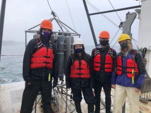
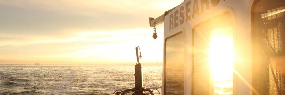
We went on two separate research cruises with 4 students each time (for COVID safety) on the School of Oceanography’s R/V Rachel Carson. The first cruise had spectacularly great weather. Students collected benthic grab samples, CTD profiles of the water column, and collected box cores. The second cruise was a bit choppier! We hit some large waves and had to adapt our sampling plan rapidly. But the students still hung in there and collected amazing data. We even managed to sneak in a quick box core despite the weather.

Over the next few weeks we will focus on processing all this data and analyzing the results. Stay tuned to hear more about the class and their results this fall.

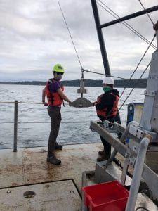
Max and Hannah deploying the shipek (they’re smiling under those masks!)

Pod Dam weathering the rough seas with a smile!

Hannah is sad that the shipek failed to collect a sample

Max, Chris, and Hannah (from Pod Baddies) prep instruments for deployment

Alex recovering the Shipek

Back to Myanmar

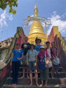
This past week the Sediment Dynamics Group was back in Myanmar! Andrea and I presented results at the International Joint Symposium at Pathein University. The focus of the symposium was “Challenges in educational development on agricultural and food resources in tropical Asia”. It was very different from the usual presentations we see! There were lots of talks about rice farming and fishing. But we met up with some old friends and made some new ones too. It’s always exciting to connect with researchers from other countries.

After the symposium we met up with Aaron and Evan, and headed back to Meinmahla Island to collect some new data. For the past 2-3 years, we’ve been investigating sedimentary processes in different types of tidal channels in the island. The island is a mangrove preserve, so we’re able to study processes in a natural environment. There are also agricultural fields along the banks of the river near the island, so we can investigate processes in a modified landscape. It’s an ideal study site! There are also lots of crocodiles, snakes, and centipedes (oh my!).

Even though it’s the rainy season we had amazing weather, and there was only one downpour. We measured water and sediment flow in the tidal channels and surveyed the island. We collected lots of videos of the river banks so that we can understand how the bank shapes change through the island. We also measured the elevation of the island and agricultural fields. It was a long week of hot work, but we got some awesome data!

CERMIT the tripod has landed!

The sediment dynamics group has been thinking deep thoughts lately–170 meters deep, to be exact. This winter, the lab outfitted a new benthic tripod frame with instruments to quantify sediment transport in Astoria Canyon, the submarine counterpart to the Columbia River. Fast forward to this May, the lab hitched a ride on the RV Oceanus for a week and set our tripod in the head of the Canyon to record a summer of canyon events and processes. While the Oceanus pitched and rolled a few extra degrees with its heavy lift crane atop the second story, the ship and its crew were wonderful help in nestling our tripod safely into the narrow canyon head.

Both amphibious and gangly, we believe the acronym CERMIT will stick (Canyon Edge ReMote In-situ Tripod), though fans should feel free to write in with their suggestions. CERMIT is outfitted with a long list of additional acronyms: multiple ADCPs, OBSs, CTDs, an ABS, a LISST, and more. These instruments will tell us precisely where and how fast the water is moving, and the concentration of sediment along for the ride. This summer, with a bit of luck, we will catch a few of the sediment-gravity flows that travel through Astoria Canyon, and determine what caused them: earthquakes, dredging for fish, or the (less-and-less) mighty Columbia may be the culprits. This information, in turn, helps our lab and other geologists interpret sedimentary deposits nearby and across the globe.

Stay tuned for its recovery and results this September!

UW vans arrive at the Oceanus carrying the tripod (deconstructed for travel). After this photo was taken, we got to work assembling it in the sunshine!

After construction on the dock, a crane brings the tripod aboard the Oceanus.

On the morning of deployment, the tripod is moved under the A-frame for lowering.

The tripod sneaks overboard, with everyone thankful for small swell.

Goodbye for now, CERMIT!

Mesophotic reefs at the Amazon River mouth: an inconvenient truth

Did you know that there’s a reef near the mouth of the Amazon River?

Reefs off the Amazon River mouth at ~180 m depth, close to the Brazil-French Guiana border. They’re, thriving from abundant nutrients but with less light and more suspended sediment.

Our group has recently been involved in the study of the mesophotic reefs that are at the outer shelf where the Amazon River discharges into the Atlantic Ocean. Mesophotic means that the reef is composed of organisms that use photosynthesis to grow and organisms that don’t need light to grow.

Although evidence of a reef system in the region has been presented since the ‘70s, a simplistic view remained that the Amazon River plume prevented reef development. The existence of this reef system is now incontestable, due to results from scientific cruises performed in cooperation with the Brazilian Navy in 2014 and 2017, as well as with Greenpeace, in 2017 and 2018.

The  area is also facing potential threat from new oil & gas exploration, resulting in conflicting interests between environmental conservation and exploration of natural resources. Although oil companies themselves recognize the reef existence and its relevance, there have been unscrupulous people trying to convince the authorities and general public that the reef does not even exist (aka fake news).

Our mission is to better understand this reef system and how it survives so close to the Amazon River plume. The plume carries much suspended sediment, which decreases the light reaching the sea bed. We are working to understand the dynamics of suspended sediments of the Amazon River and the sedimentary and oceanographic mechanisms that enable this reef system to exist.

Recent field work in Myanmar

The lab just finished a short, two-week trip to Myanmar. The primary goal of this trip was to discuss research with our Burmese colleagues. We participated in a conference at Yangon University, where we also heard presentations from American colleagues who have been working in the Gulf of Martaban.

Aaron preparing to discuss results with collaborators from VIMS and Yangon University

Next we presented our results at Pathein University, where we also led a data processing workshop and a short research trip on the Pathein River.

Filtering water samples doesn’t have to be boring!

We also managed to fit in two days of field work on the Yangon River with Myanmar Maritime University. During the winter period of dry weather, the river discharge decreases, and the amount of sediment in the water increases. During our previous trip, in March 2018, we measured as much as 15 grams of sediment per liter and our acoustic instruments didn’t work! This time, we came prepared for very high sediment concentrations. We were able to track the high concentrations during a full tidal cycle and also measure the river discharge. It’s very exciting to see such an extreme riverine environment!

Large vessels using the Yangon River. This one parked in the middle of our sampling location.

Improvised raft for measuring water flow.

Our Yangon River crew

Ocean Networks Canada Workshop: Seafloor collapse and submarine canyons

This month Ocean Networks Canada held a workshop in Victoria, BC focused on the “seabed and sediment in motion” at their observatory sites. They have cabled instruments on the seafloor that continually send data back to shore. The workshop focused on studies at two contrasting focus sites, one on the Fraser River delta, and the other in Barkley Canyon on the continental margin. Submarine canyons are dramatic features of continental margins throughout the world. They can be many kilometers deep and cut far into the shelf, like a Grand Canyon deep underwater. These canyons are hotspots of biological activity as well as conduits for sediment, nutrients, chemicals, and trash. Andrea Ogston attended the workshop to present collaborative research from Barkley Canyon and hear results from colleagues.

Map of a few of the instrumented ONC observatory sites in Barkley Canyon. Our margin off the west coast of the US/Canada is incised by numerous submarine canyons.

On the Fraser Delta, frequent mass failures of the seafloor and energetic gravity flows pose potential problems for the coastal port structures.  Dr. Gwyn Lintern, PGC, showed a dramatic data set from sensors that tumbled in a bottom flow recording velocities of 6-8 m/s, and eventually disconnected and disappeared!  In contrast, Barkley Canyon located off the coast of Vancouver Island has a very limited source of sediment at present, and dynamics are not as dramatic. However, Andrea Ogston showed two modes of particulate transport at ~1000 m water depth within the canyon axis:  1) relatively dense fine particles move down the canyon, carried by residual currents, and are at times pumped back up-canyon by tides, and 2) loose, fluffy phytodetritus (chunks of tiny organisms) from the surface ocean are mixed down into the canyon and during winter downwelling periods can be rapidly transferred to the deep ocean.  This winter process has the potential of adding significantly to the biological pump (which transports carbon to the deep sea). If you’re interested in reading more, check out Thomsen et al., 2017.

After a presentation and discussion of what can be done with the existing data on the Oceans Network Canada observatories, the workshop turned to needs and wants that could enable the next steps in the scientific discovery using the observatory data streams.  New, updated sensors and a reconfiguration of Barkley Canyon’s sensor array will be upcoming and will allow the scientific community to further explore the importance of the wintertime delivery of carbon to the deep sea.  Stay tuned for more on this exciting discovery!

Victoria BC at night during the ONC Seabed and Sediment in Motion Workshop