CERMIT the tripod has landed!

The sediment dynamics group has been thinking deep thoughts lately–170 meters deep, to be exact. This winter, the lab outfitted a new benthic tripod frame with instruments to quantify sediment transport in Astoria Canyon, the submarine counterpart to the Columbia River. Fast forward to this May, the lab hitched a ride on the RV Oceanus for a week and set our tripod in the head of the Canyon to record a summer of canyon events and processes. While the Oceanus pitched and rolled a few extra degrees with its heavy lift crane atop the second story, the ship and its crew were wonderful help in nestling our tripod safely into the narrow canyon head.

Both amphibious and gangly, we believe the acronym CERMIT will stick (Canyon Edge ReMote In-situ Tripod), though fans should feel free to write in with their suggestions. CERMIT is outfitted with a long list of additional acronyms: multiple ADCPs, OBSs, CTDs, an ABS, a LISST, and more. These instruments will tell us precisely where and how fast the water is moving, and the concentration of sediment along for the ride. This summer, with a bit of luck, we will catch a few of the sediment-gravity flows that travel through Astoria Canyon, and determine what caused them: earthquakes, dredging for fish, or the (less-and-less) mighty Columbia may be the culprits. This information, in turn, helps our lab and other geologists interpret sedimentary deposits nearby and across the globe.

Stay tuned for its recovery and results this September!

UW vans arrive at the Oceanus carrying the tripod (deconstructed for travel). After this photo was taken, we got to work assembling it in the sunshine!

After construction on the dock, a crane brings the tripod aboard the Oceanus.

On the morning of deployment, the tripod is moved under the A-frame for lowering.

The tripod sneaks overboard, with everyone thankful for small swell.

Goodbye for now, CERMIT!

Science Writing for Diverse Audiences

This quarter, I’m up at Friday Harbor Labs teaching Science Writing for Diverse Audiences. As a class, we are exploring effective ways to read, write, and commicate science – all the way from peer-reviewed articles to op-eds and blog posts.

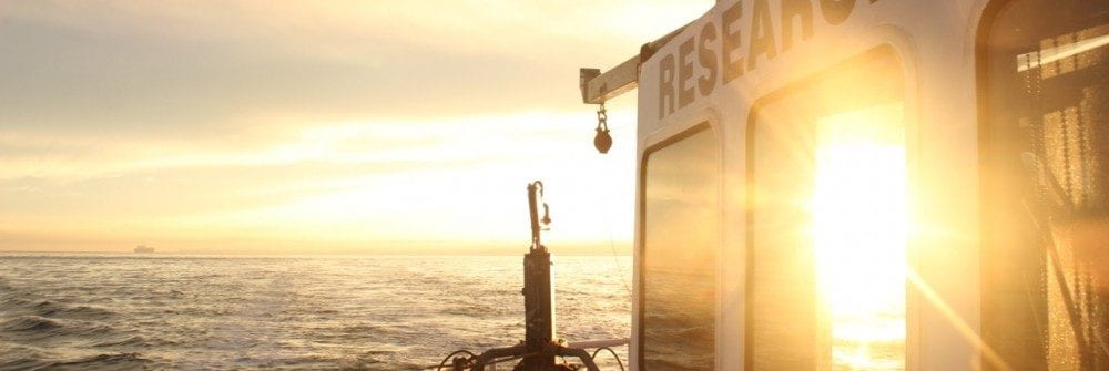
Friday Harbor is an excellent place to find inspiration to write. This past week, we headed out on the R/V Centennial to explore ecosystems around the island. We dug through sand and shell hash to get our hands on wriggly sand lances. We sifted through dredge material to find slime stars and anemomes. And, we gazed through microscopes to spot a myriad of zooplankton. The students’ enthusiasm clearly demonstrated their curioisity and love of natural science. We practice effectivelly describing our experiences with thoughtfully structured sentences, active verbs, and descriptive adjectives – skills that are needed to write well-received science articles.

Students explore rocks and organisms pulled up from the seabed.

Zooplankton under a microscope were displayed for all of us to see and discuss.

Students practice describing what they see in words.

But, this group of students has self selected to be here, and we’ve discussed that not everyone shares our views of science. Perspective colors how science is performed and perceived. Even within this self-selected classroom, students represent diverse views of science. As individuals, we tend to see science as beautiful and inviting. But, our families and cultures tend to see science more as a means to financial gain, often with devious conotations.

Students describe their own, their family’s, and their identified culture’s perception of science.

So, to add to our list of writing skills, we also practice how to frame our writing to fit our audience’s perspective. Research shows that scientists are often viewed as trustworthy, but cold. So, to present ourselves as authors that are both competent and warm, we practice contructing narrative arcs and adding humor and personality.

The quarter isn’t even half way over, and the students  are already better writers. Their arguments are persuasive, their desciptions are vivid, and their confidence is rising. I expect to see great things from this group. After all, science is often not driven by the best scientists, but instead by the best communicators.

Written by Robin McLachlan

Cooking Myanmar Food in Seattle!

Our lab has an ongoing research project examining sediment dynamics within the mangrove forests and distributary channels of the Ayeyarwady Delta in Myanmar.  During each of our field efforts we are enchanted by the food of Myanmar, which has hints of Thai, Chinese, or Indian influence, but is ultimately a cuisine all its own.

After tracking down a number of hard-to-find ingredients, we gathered to create our Burmese feast right here in Seattle.  In the end we made Yinmabin-Chowle Kyattha (chicken curry with okra), julienne green beans with garlic, Bottle gourd soup, and Shrimp Tom Yum Goong Soup.  This last dish is actually a Thai classic, but we made it as an homage to our favorite Thai Restaurant in all of Myanmar, the famous “G7 Gym and Restaurant” in the city of Pathein, located on the westernmost distributary of the Ayeyarwady Delta.

While we can’t claim to have mastered any of these dishes, it was fun to bring a bit of Myanmar cuisine to friends and family back here in Seattle.

Mesophotic reefs at the Amazon River mouth: an inconvenient truth

Did you know that there’s a reef near the mouth of the Amazon River?

Reefs off the Amazon River mouth at ~180 m depth, close to the Brazil-French Guiana border. They’re, thriving from abundant nutrients but with less light and more suspended sediment.

Our group has recently been involved in the study of the mesophotic reefs that are at the outer shelf where the Amazon River discharges into the Atlantic Ocean. Mesophotic means that the reef is composed of organisms that use photosynthesis to grow and organisms that don’t need light to grow.

Although evidence of a reef system in the region has been presented since the ‘70s, a simplistic view remained that the Amazon River plume prevented reef development. The existence of this reef system is now incontestable, due to results from scientific cruises performed in cooperation with the Brazilian Navy in 2014 and 2017, as well as with Greenpeace, in 2017 and 2018.

The  area is also facing potential threat from new oil & gas exploration, resulting in conflicting interests between environmental conservation and exploration of natural resources. Although oil companies themselves recognize the reef existence and its relevance, there have been unscrupulous people trying to convince the authorities and general public that the reef does not even exist (aka fake news).

Our mission is to better understand this reef system and how it survives so close to the Amazon River plume. The plume carries much suspended sediment, which decreases the light reaching the sea bed. We are working to understand the dynamics of suspended sediments of the Amazon River and the sedimentary and oceanographic mechanisms that enable this reef system to exist.

The Brazilian branch of the Sediment Dynamics Group

Nils and family at Drumheller Fountain, UW-Seattle

Nils outside the UFPA campus in Braganca.


Nils and his family have returned to Bragança, but they’re keeping in touch! Here’s his news on settling back into life and work in Brazil:

After spending one very pleasant and fruitful year at UW-Seattle, I’m back home in Bragança, Brazil where I work at the UFPA campus. Right now, the challenges for science are bigger than ever in Brazil, but the scientific tools I brought from UW are really helping me through. One major challenge is the drastic decrease in public funding for research for all disciplines and levels. I’m overcoming this impediment by taking advantage of all the data collected along the lower Amazon River, Tapajós and Xingu tributaries, as well as along the Brazilian Amazon mangrove belt and at the Amazon shelf. All this data is a result of large cooperative fieldwork efforts during the last five years. This backlog assures us long hours of data analysis at the lab and even more time trying to understand and publish the results. We have been making good progress so far, with the recent publication of papers in journals such as Estuarine, Coastal and Shelf Science; Earth Surface, Processes and Landforms; and Geochimica et Cosmochimica Acta. Several papers are under review as well and are coming out soon.

Stay tuned to our blog to hear more from Nils and get notifications for his upcoming publications!

Recent field work in Myanmar

The lab just finished a short, two-week trip to Myanmar. The primary goal of this trip was to discuss research with our Burmese colleagues. We participated in a conference at Yangon University, where we also heard presentations from American colleagues who have been working in the Gulf of Martaban.

Aaron preparing to discuss results with collaborators from VIMS and Yangon University

Next we presented our results at Pathein University, where we also led a data processing workshop and a short research trip on the Pathein River.

Filtering water samples doesn’t have to be boring!

We also managed to fit in two days of field work on the Yangon River with Myanmar Maritime University. During the winter period of dry weather, the river discharge decreases, and the amount of sediment in the water increases. During our previous trip, in March 2018, we measured as much as 15 grams of sediment per liter and our acoustic instruments didn’t work! This time, we came prepared for very high sediment concentrations. We were able to track the high concentrations during a full tidal cycle and also measure the river discharge. It’s very exciting to see such an extreme riverine environment!

Large vessels using the Yangon River. This one parked in the middle of our sampling location.

Improvised raft for measuring water flow.

Our Yangon River crew

Heading to the AGU Fall Meeting

It’s conference season again, and our lab is headed to Washington D.C. to meet and mingle with other scientists and students. Here is what we will be chatting about this time.

First up, our recent research in the Ayeyarwady Delta:

Andrea’s poster: Sedimentary Processes in the Tidal River to Estuarine Reach of the Ayeyarwady Delta (EP13C-2114)

Monday, 13:40 – 18:00 

Walter E Washington Convention Center Hall A-C (Poster Hall)

As the Ayeyarwady River approaches the Andaman Sea, it splits into multiple delta distributary channels, which together discharge >108 t/y of sediment. This study aims to understand: sediment retention and geomorphic variability through the lower distributaries, deltaic growth along mangrove shorelines, and sediment export to the coastal ocean.

Aaron’s Poster: Temporal variability in suspended-sediment dynamics within three distributaries of the Ayeyarwady Delta, Myanmar (EP13C-2113)

Monday, 13:40 – 18:00 

Walter E Washington Convention Center Hall A-C (Poster Hall)

The Ayeyarwady River is one of the largest sources of sediment to the global ocean. However, little is known about the timing, character, or routing of that sediment within the large Ayeyarwady Delta, which is building into the northern Andaman Sea. This study examines how the suspended loads of these distributaries vary spatially (along and between distributaries) and temporally (decennially, seasonally, fortnightly) using in-situ and remote-sensing approaches.

Later that afternoon, our recent research in Brazilian tidal channels:

Robin’s Talk: The Impacts of Channel Connectivity on Tidally-Driven Sediment Transport and Accumulation in a Mangrove Forest (OS14B-03)

Monday, 16:30 – 16:45

Walter E Washington Convention Center – 103AB

Mangrove forests provide many valuable ecosystem services, including wave- and tidal-energy dissipation, sediment accumulation, and substrate stabilization. But, their global extent is rapidly shrinking. Sediment cores and in-situ observations of water and sediment flux were obtained in two tidal channels near the Amazon River mouth to characterize how connectivity impacts tidally-driven sediment transport and accumulation in coastal mangrove forests.

Wrapping up our presentations, our research on the Elwha nearshore:

Hannah’s Talk: Nearshore benthic light attenuation due to sediment transport following dam removal on the Elwha River, WA: In-situ observations and statistical modeling (OS21B-08)

Tuesday, 09:45 – 10:00

Walter E Washington Convention Center – 103AB

The 2011–2014 removal of two dams from the Elwha River, WA provided an opportunity to study the sensitivity of a coastal ecosystem to a large-scale sediment input event. During the dam removal, >10 Mt of sediment was exported to the marine environment. Macroalgae, the primary habitat-forming species in the nearshore, disappeared from the region. Models were created to hindcast to light availability during the dam removal. Benthic light availability was found to be below the threshold for macroalgae growth, supporting the hypothesis that reduced light availability caused the mortality event.

Ocean Networks Canada Workshop: Seafloor collapse and submarine canyons

This month Ocean Networks Canada held a workshop in Victoria, BC focused on the “seabed and sediment in motion” at their observatory sites. They have cabled instruments on the seafloor that continually send data back to shore. The workshop focused on studies at two contrasting focus sites, one on the Fraser River delta, and the other in Barkley Canyon on the continental margin. Submarine canyons are dramatic features of continental margins throughout the world. They can be many kilometers deep and cut far into the shelf, like a Grand Canyon deep underwater. These canyons are hotspots of biological activity as well as conduits for sediment, nutrients, chemicals, and trash. Andrea Ogston attended the workshop to present collaborative research from Barkley Canyon and hear results from colleagues.

Map of a few of the instrumented ONC observatory sites in Barkley Canyon. Our margin off the west coast of the US/Canada is incised by numerous submarine canyons.

On the Fraser Delta, frequent mass failures of the seafloor and energetic gravity flows pose potential problems for the coastal port structures.  Dr. Gwyn Lintern, PGC, showed a dramatic data set from sensors that tumbled in a bottom flow recording velocities of 6-8 m/s, and eventually disconnected and disappeared!  In contrast, Barkley Canyon located off the coast of Vancouver Island has a very limited source of sediment at present, and dynamics are not as dramatic. However, Andrea Ogston showed two modes of particulate transport at ~1000 m water depth within the canyon axis:  1) relatively dense fine particles move down the canyon, carried by residual currents, and are at times pumped back up-canyon by tides, and 2) loose, fluffy phytodetritus (chunks of tiny organisms) from the surface ocean are mixed down into the canyon and during winter downwelling periods can be rapidly transferred to the deep ocean.  This winter process has the potential of adding significantly to the biological pump (which transports carbon to the deep sea). If you’re interested in reading more, check out Thomsen et al., 2017.

After a presentation and discussion of what can be done with the existing data on the Oceans Network Canada observatories, the workshop turned to needs and wants that could enable the next steps in the scientific discovery using the observatory data streams.  New, updated sensors and a reconfiguration of Barkley Canyon’s sensor array will be upcoming and will allow the scientific community to further explore the importance of the wintertime delivery of carbon to the deep sea.  Stay tuned for more on this exciting discovery!

Victoria BC at night during the ONC Seabed and Sediment in Motion Workshop

Show and Tell

People in earth science spend a lot of time thinking about the places we study. We work to understand how this mysterious place functions: we read papers, crunch equations, and scroll into satellite imagery. And then, with a van full of gear and a new set of questions, we drive until we find ourselves standing in that very place. It can be a powerful moment, and no one knows the feeling better than seasoned scientists. Chuck and Dave (both seasoned) are teaching a course this term, Rivers and Beaches, focused on giving students that duality. The class begins in a lecture hall, but students are soon out on field trips to the mountains, rivers, and beaches of the beautiful pacific northwest.

Students in this year’s class have now stayed up into the small hours of the night studying geology and oceanography for their midterm exam (today!), but they have also seen and touched these places. Last month, we traveled the length of the Nisqually river from its glacial headwaters to its salty estuary, tracking its transformation from rocky braided channels to gentle downstream meanders. Last week, the students were on a cruise of Puget Sound, testing classroom concepts by lowering CTD rosettes into the water and winching kasten cores out of the Sound’s muddy bed. Textbooks cannot offer the intuition and appreciation for these places and phenomena; building stronger students requires we show them, not simply tell.

It’s too early to tell who in the class will major in a geoscience, but we have one more trip to convince them, amongst the foggy mountains and sandy spits of the Olympic peninsula.

Dave and Chuck on the Nisqually river.

Dave discusses the consequences of a dam along the Nisqually river.

Hustle and bustle as students touch a Shipek sediment sample taken by the R/V Carson.

Observing texture on a 15×180 cm kasten core taken from Puget Sound (core bottom in the foreground).